
Bagh Mhungasdail


Township (Post Medieval)
Site Name Bagh Mhungasdail
Classification Township (Post Medieval)
Alternative Name(s) Mungasdale
Canmore ID 105100
Site Number NG99SE 7
NGR NG 9702 9361
NGR Description Centred NG 9702 9361
Datum OSGB36 - NGR
Permalink http://canmore.org.uk/site/105100


- Council Highland
- Parish Lochbroom
- Former Region Highland
- Former District Ross And Cromarty
- Former County Ross And Cromarty
Note
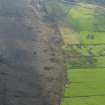
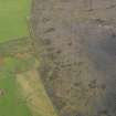
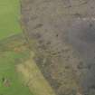
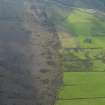
A township comprising one roofed, one partially roofed and twelve unroofed buildings and eleven enclosures is depicted on the 1st edition of the OS 6-inch map (Ross-shire and Cromartyshire 1881, sheet xx). Seventeen unroofed buildings and ten enclosures are shown on the current edition of the OS 1:10560 map (1969).
Information from RCAHMS (SAH) 13 February 1996.

