
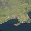
Unknown: North Strome Slipway, Loch Carron


Boat, Craft
Site Name Unknown: North Strome Slipway, Loch Carron
Alternative Name(s) Strome Castle; Stromeferry; Inner Sound; Unknown
Canmore ID 101936
Site Number NG83NE 8002
NGR NG 86335 35335
Datum WGS84 - Lat/Long
Permalink http://canmore.org.uk/site/101936

- Council Highland
- Parish Maritime - Highland
- Former Region Highland
- Former District Maritime
- Former County Not Applicable
NG83NE 8002 8633 3534
N57 21.51 W5 33.1667
Formerly entered as NG83NE 8445.
NLO: Strome Castle [name: NG 863 354]
Stromeferry [name: NG 865 346]
Loch Carron [name centred NG 83 34]
Inner Sound [name centred NG 64 40].
Quality of fix = EDM
Horizontal Datum = OGB
Surveying Details
-----------------------------
8 January 1987. A wooden hulled boat, 9 metres long (29.5 feet) and 3 metres beam (9 feet), is stranded on the west side of the north Strome slipway, at 57 21 33N, 005 33 12W. NGR - eastings 186300.7, northings 835399.3.
Report by HMS ENDURANCE.
Hydrographic Office, 1995.
Reference (19 April 2012)
UKHO Identifier : 002004
Feature Class : Wreck
Wreck Category : Wreck showing any portion of hull or superstructure
State : DEAD
Classification : Unclassified
Position (Lat/long) : 57.35822,-5.55393
Horizontal Datum : ETRS 1989
WGS84 Position (Lat/long) : 57.35822,-5.55393
WGS84 Origin : Block Shift
Previous Position : 57.35822,-5.55393
Position Method : Electronic Distance Measuring System
Position Quality : Precisely known
Depth Quality : Depth unknown
Water Depth : -1
Vertical Datum : Lowest Astronomical Tide
Name : UNKNOWN
Type : WOODEN BOAT
Sonar Length : 9.0
Sonar Width : 3.0
Bottom Texture : Rock
Contact Description : Entire wreck
Original Sensor : Video Sensor
Original Detection Year : 1987
Original Source : Survey Vessel
Surveying Details : **H2172/86 8.1.87 WOODEN HULLED BOAT, 9MTRS LONG, 3MTR BEAM, STRANDED ON W SIDE OF N STROME SLIPWAY IN 572130.6N, 053310W [OGB]. (HMS ENDURANCE, HI 343). INS AS ST. NE 2528.
POSITIONS BELOW THIS POINT ARE IN DEGREES, MINUTES AND DECIMALS OF A MINUTE
**13.8.05 [EUT] POSN: 5721.493N, 0533.236W. NE 2528.
**SEP 2012/000055142 27.3.12 NOT SHOWN ON STROME FERRY SLIPWAY (NORTH) SURVEY DTD 1.3.12. (ASPECT LAND & HYDRO SURVEYORS FOR THE HIGHLAND COUNCIL, HARBOURS MANAGER, LOCHINVER). AMEND DEAD.
General Comments : DIMENSIONS AS REPORTED
Chart Symbol : ST
Date Last Amended : 27/03/2012
Date Position Last Amended : 13/08/2005

