
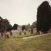
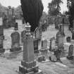
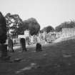
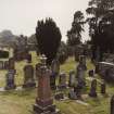
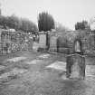
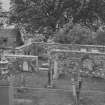
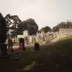
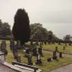
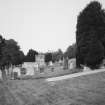
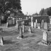
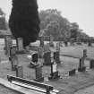
Boleskine, Old Boleskine Church, Burial Ground


Burial Ground (Period Unassigned)
Site Name Boleskine, Old Boleskine Church, Burial Ground
Classification Burial Ground (Period Unassigned)
Canmore ID 100574
Site Number NH52SW 5.01
NGR NH 50750 22141
NGR Description Centred NH 50750 22141
Datum OSGB36 - NGR
Permalink http://canmore.org.uk/site/100574


- Council Highland
- Parish Boleskine And Abertarff
- Former Region Highland
- Former District Inverness
- Former County Inverness-shire
NH52SW 5.01 50750 22141
The date of erection of Boleskine church cannot be ascertained, but it was destroyed c. 1777, in which year the present church, at Druim an Teampuill, was built. The graveyard in which the old church stood was being used for interments in 1870's (Name Book 1871) The church is marked 'in ruins' on Taylor & Skinners' map (G Talyor and A Skinner 1776).
(Undated) information in NMRS.
There is no trace of the church. The burial ground has been enlarged and is still in use.
Visited by OS (R L) 17 December 1969

