Field Visit


Date 5 July 1954
Event ID 925518
Category Recording
Type Field Visit
Permalink http://canmore.org.uk/event/925518
Fort, Dunwan.
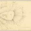
Dunwan Hill, which rises to a height of 980 feet OD two and a half miles SW of Eaglesham, stands near the northern limit of the tract of hilly marshland which occupies the southern part of Eaglesham parish. From the summit plateau the SE, NE and NW flanks fall steeply to the immediate base of the hill, while to the SW, after a similarly steep drop of 15 feet, a longer and easier slope descends to marshy ground through which runs a nameless tributary of the Blackwood Burn. The fort, which occupies the summit plateau, is triangular on plan [DP 149888] and measures 260 feet from NE to SW by 160 feet transversely within a wall or a terrace-rampart. The latter is now represented only by outer facing stones which appear sporadically on a line about 12 feet outside and as much below the NE, E and SE arcs of the present rim of the plateau. The entrance, 10 feet wide, is situated at the SE, at the apex of the triangle. The interior is covered with coarse pasture and patches of rushes and contains what may be the remains of hut circles. One of these, situated 50 feet NE. of the entrance, consists of a shallow trench about 2 feet in width enclosing an area which measures about 26 feet in diameter. A causeway about 4 feet in width in the N. arc probably represents the entrance. The other feature is an arc of a similar trench measuring 33 feet in length and forming part of a circle out 22 feet in diameter.
Immediately outside the entrance to the fort a slightly hollowed track runs down the steep slope for a distance of 50 feet to die out where the more gently sloping SE flank of the hill starts. At this point the line of the track is flanked by the ends of two ditches, 10 feet in width and 20 feet apart, and immediately outside those are the ends of a low stony mound, spread to a width of about 13 feet, which must represent a very decayed outer rampart. The gap in the rampart is crossed by a modern but ruinous dyke which runs along the top of the rampart and, in the centre of the gap, is joined at right angles by another dyke that runs up the slope from the SW. To the SE of the entrance gap the mound soon becomes nothing more than a scarp and the ditch a terrace, and together these features run in an arc SE and E on to the S flank of the hill. For the first 90 feet they are accompanied by the dyke, which afterwards turns off SSE down the hill. The terrace having lapsed after a distance of 150 feet, a crest line representing the rampart can be followed for a further 70 feet before it fades on the steep rocky SSE. flank of the hill. To the of the entrance gap the scarp of the rampart is accompanied NNW for 50 feet by that terrace and for 70 feet by the dyke. Thereafter the crest line traverses the flank of the hill for 200 feet before fading out on the steep rocky slope. After a gap of 250 feet, during which it is possible to see only the faintest traces of the crest line, this can be distinguished again on the NE flank of the hill and followed thence E and SE for 100 feet, at which point there is a gap about 25 feet in width. Beyond this the crest line runs on for 150 feet before becoming lost on the E. flank of the hill. Examination of the air-photographs on which the fort was first observed (541/A/527, 4016-7) suggests that this crest line did originally encircle the hill completely.
The siting of a rampart so far down the slope is a striking feature; at the points 200 feet on either side of the entrance in the SE arc the vertical distance from the rim of the summit plateau to the crest-line is 50 feet, while at the opposite end of the site the horizontal separation is 160 feet.
The surface of the ground at the immediate base of the hill is confused with tumbled boulders, drainage trenches, field boundaries and, on the N, by the ruins of buildings. Among these are the fragmentary remains of what might possibly have been a third rampart, distant about 70 feet outside the second and running round at least the NW, NE and SE of the bottom of the hill. But the possibility that this belonged to the ruined buildings which are set just within it cannot be ruled out.
Visited by RCAHMS (RWF) 5 July 1954.