RCAHMS Special Survey, Mine Howe


Date 15 November 1999 - 18 November 1999
Event ID 1107311
Category Recording
Type Field Visit
Permalink http://canmore.org.uk/event/1107311
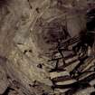
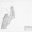
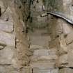
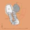
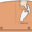
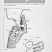
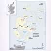
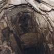
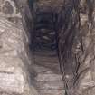
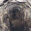
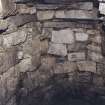
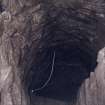
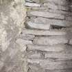
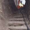
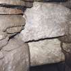
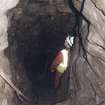
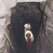
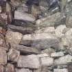
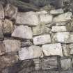
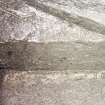
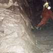
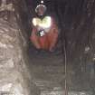
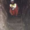
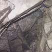
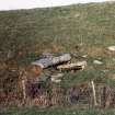
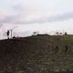
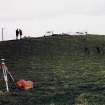
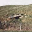
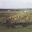
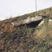
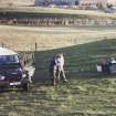
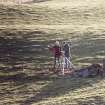
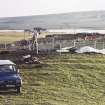
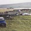
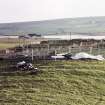
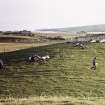
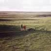
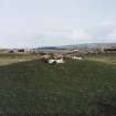
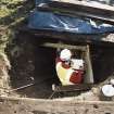
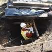
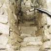
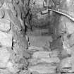
This subterranean structure has been sunk into a natural mound in an area of undulating ground about 100m SE of the cemetery on Churchyard Road, Tankerness. The mound itself, which is indistinguishable from other natural mounds in the vicinity, is about 3m in height, and it formerly lay at the centre of an oval ditched enclosure measuring some 41m from N to S by 37m transversely internally, with a broad entrance facing towards the W (Card et al. 2000 (NMRS MS 1040/3), GSB 1999 (NMRS MS 2000/1)). No trace of the ditch is now visible, but the mound occupies the whole of the interior, and the ground rises gradually from roughly the line of its inner lip to the summit where a modern pit has been sunk and now provides access to the mouth of the structure below. Built of drystone masonry, the latter lies beneath the centre of the mound and comprises two flights of stone steps, the upper of which leads down to a half-landing and the entrances to two subsidiary galleries, and the lower on down to a corbelled chamber at the bottom.
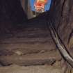
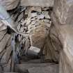
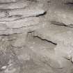
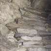
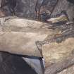
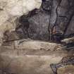
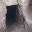
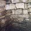
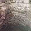
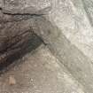
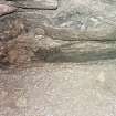
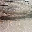
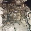
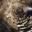
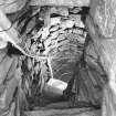
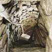
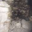
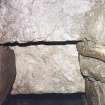
The structure appears to have been constructed in a pit about 4.4m in diameter, and the floor of the corbelled chamber at the bottom lies 7.4m below the top of the mound. The pit in the summit, which now contains metal stairs, has been dug down 1.85m, revealing that the material above the structure is composed of unconsolidated earth and stone, perhaps largely derived from midden. The upper flight, comprising seventeen ladder-like steps, drops down from N to S between coursed drystone walls for a further 2.75m to the half-landing on to which the two subsidiary galleries open. The S wall of the half-landing is formed by natural till, and presumably forms the S side of the pit in which the structure is built. The entrance to the lower gallery is about 0.6m square and its sill is 0.43m above the half-landing; the gallery itself is no more than 0.4m in width at one point and it extends back in a shallow arc for about 2.4m. The upper gallery, the sill of its entrance 1.42m above the half-landing, runs back above the roof of the lower flight of steps and the corbelled chamber; some 2.8m in length, it is much wider and higher than the lower gallery, measuring up to 0.9m in width and 1.25m in height at its inner end. Midden deposits are visible on the N side where the masonry at the inner end has collapsed. The capstones of the roof above the ladder steps is about 2.7m above the half-landing, but two other lintels span the void, acting as tie-beams between the walls flanking the steps. This structural technique relieves the dead-weight of the masonry above the structure, and, whatever other functions the galleries may have fulfilled, they too serve this purpose.
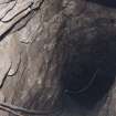
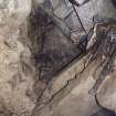
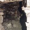
From the half-landing the stair turns back on itself, descending a further 1.9m in a flight of eleven steps to a sill 0.9m above the floor of the corbelled chamber. The latter is about 1.3m in diameter and the capstones of its roof are 4.1m above the floor. The drop down from the lowest step gives the chamber a cistern-like appearance, and the fissures between two massive sandstone slabs forming the floor, which are probably bedrock, are filled with clay. The chamber does not hold water at present, but the present water table may be below the level of its floor.
It is noteworthy that the top flight of steps is oriented to face N, minimising the ingress of light into the structure. The drystone wall construction, the ladder-like steps and the various techniques for relieving the dead-weight of the structure, suggest an Iron Age date, and this is supported by evidence from the recent excavations (Card et al. 2000). The 'well' inside the Broch of Gurness (HY32NE 5; Fojut 2001) provides a good analogy and other parallels are listed by Hedges (1987).
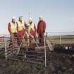
Visited by RCAHMS (DCC) 19 November 1999
(N Fojut 2001; JW Hedges 1987 ; GSB, 1999 (NMRS MS 2000/1); N Card, J Downes and J Gibson 2000 (NMRS MS 1040/3))