HES Whiteadder Archaeological Survey


Date October 2019 - April 2021
Event ID 1094074
Category Project
Type Project
Permalink http://canmore.org.uk/event/1094074
A survey of the upper catchment of the Whiteadder Water (392 km²) was undertaken by the Archaeological Survey team of Historic Environment Scotland between October 2019 and March 2021, with fieldwork carried out in spring and autumn 2020. The survey formed part of the Rapid Archaeological Mapping Programme, a research and development project designed to develop processes and protocols for the rapid enhancement of the National Record of the Historic Environment (NRHE), drawing heavily on high-resolution remote-sensing data. The aims of the survey were: (i) to enhance the NRHE through a combination of record revision and the identification of new sites; (ii) to further develop procedures for the rapid archaeological mapping of large areas that emphasise speed and economy; and (iii) to capitalise on the availability of Airborne Laser Scanning (ALS) data. The project was managed by George Geddes and the project executive was David Cowley.
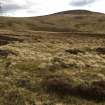
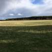
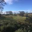
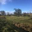
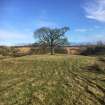
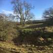
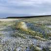
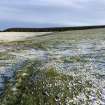
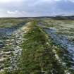
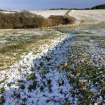
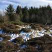
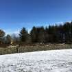
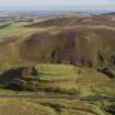
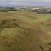
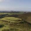
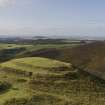
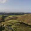
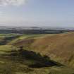
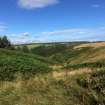
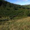
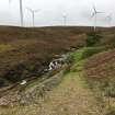
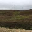
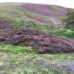
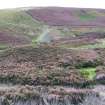
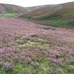
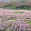
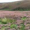
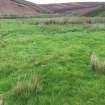
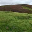
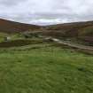
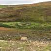
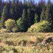
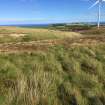
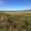
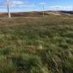
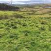
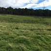
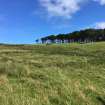
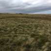
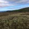
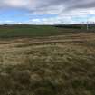
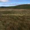
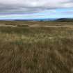
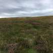
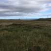
The survey encompassed an oblong area measuring about 16km from the Monynut Edge in the NE to Twin Law in the SW, by some 35km from Auchencrow at the SE to Luggate Burn in the NW, with about two thirds of the study area lying within the Scottish Borders and the remainder in East Lothian. A central swathe of the study area lies above 300m OD in the Lammermuir Hills and is principally given over to grouse moor, while the lower ground is heavily improved and there is a significant area of coniferous plantation between the Bothwell and Monynut Waters.
The survey was mainly concerned with discrete archaeological features, with a particular focus on those that can be shown to pre-date the first edition of the OS 6-inch map, surveyed in the 1850s. Later features that have been abandoned were also included on a discretionary basis, but no attempt was made to record relict features later in date than c.1900 AD. Roofed buildings and related architectural monuments were omitted; cultivation remains, trackways, and other landscape-scale features were only included on a discretionary basis; however, the great majority of quarries and sheepfolds were recorded.
The project made use of Airborne Laser Scanning (ALS) data delivered to HES by the Scottish Government (Lidar for Scotland Phase 3). Initially captured by Fugro for Scottish Power Energy Network in 2015 and 2016 to monitor their overhead power cable network, the data also included information gathered on behalf of Scottish Borders Council in 2019. With a point density of about 30 last returns per m², the resolution of the full dataset is significantly higher than Phase 3 data available through Scottish Remote Sensing Portal (4 points per m2). The point cloud data was processed by HES to generate digital terrain models (DTM) with a resolution of 0.5m. Visualisations were subsequently produced using the Relief Visualisation Toolbox.
The survey specification was designed to ensure rapid coverage and to meet the minimum record requirements of the NRHE with specific regard to location, classification and period. The location of each site was recorded as a site-area polygon at a scale of between 1:1000 and 1:2000 and a centre point with 1m precision was subsequently generated from the polygon. The classification and period of each site was recorded in line with the specification for Level 2 in the HES Levels of Survey document.
The first phase of the project involved the revision of the classification, period and location of sites recorded in existing records. All finds and architectural records were excluded, as well as the majority for which there is only documentary evidence. In addition to the remote-sensing datasets listed above and the information provided in the NRHE, reference was made where necessary to material in the HES Archive. These included aerial photographs and related mapping, drawings and notebooks related to the work of RCAHMS, the records of the OS Archaeology Division, and other manuscript sources. Classification and period terms were drawn from existing HES nomenclature and sites were polygonised using the technical guidance for the Canmore Mapping Layer (WP007453).
In the second phase of the project, desk-based survey concentrated on the identification of new features in a desktop GIS environment. ALS datasets were viewed using a composite of DTM visualisations which included Local Dominance and Multidirectional Hillshade. Vertical aerial photographs captured up to 2018 (supplied by Getmapping plc) provided additional information, as did successive iterations of OS Historic Maps at 6-inch and 25-inch scales (supplied by the National Library of Scotland) and current OS digital and raster mapping. New features were identified with high or low confidence, to inform the third phase of the project. Those identified with a high level of confidence were double-checked by members of the project team, while those identified with a low level of confidence were first double-checked and then set aside to be visited in the field.
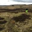
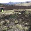
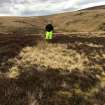
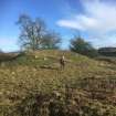
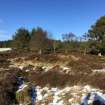
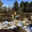
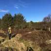
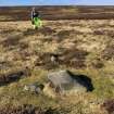
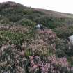
The fieldwork was carried out in February, March and September 2020, and was undertaken by Łukasz Banaszek, Georgina Brown, David Cowley, Angela Gannon, George Geddes, Katrina Gilmour, Alison McCaig, Peter McKeague and Adam Welfare. The routes taken by all staff were documented by handheld GPS.
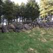
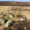
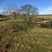
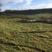
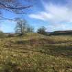
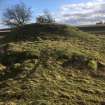
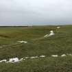
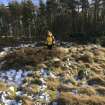
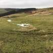
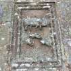
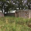
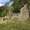
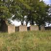
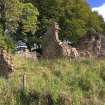
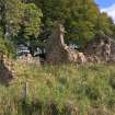
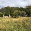
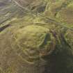
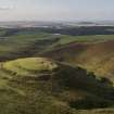
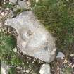
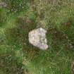
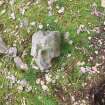
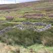
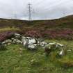
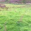
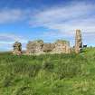
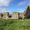
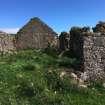
The survey encompassed 1,954 archaeological sites. This comprised the revision of 698 pre-existing site records (78 of which benefited from a field visit) and 1,256 previously unrecorded sites (a 180% increase), including 226 that were subsequently visited and 51 that were identified during fieldwork. Among the large number of newly discovered sites only 26 can be assigned with any confidence to the prehistoric or medieval periods. This low number is likely due to the high degree to which agricultural improvement has been undertaken on the lower-lying ground, the extent of previous field and aerial survey, and the character of the high ground, where poor soils dominate. The prehistoric discoveries included a probable Bronze Age burial cairn on the summit of Rangely Kip (NT66NW 72) and a burnt mound at Gowk’s Cleugh (NT66SE 121). A possible scooped settlement was identified at Damhead Plantation (NT75NE 199), and three other possible settlements (NT56NE 155 and 156, NT66SE 112) elsewhere. Among the medieval sites noted is what may be a motte and bailey castle at Castle Moffat (NT66NW 73), and farmsteads at Moss Burn and West Hopes (NT56NE 149; NT56SE 61). Of the 15 shieling sites that were discovered, only one (NT67SW 163) was identified as medieval although the largest group, at Lodge Rig (NT66NW 84), may have been in use over many years.
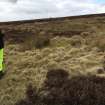
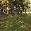
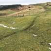
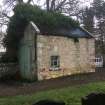
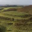
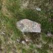
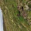
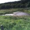
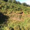
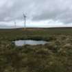
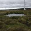
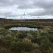
In stark contrast to the comparative lack of sites of medieval or earlier date is the wealth of material from the post-medieval period. At least 27 farmsteads were recorded, along with 21 solitary buildings and others that can be ascribed to more specific uses, such as shepherd’s cottages. The hilly nature of the ground is reflected in the discovery of 32 dams, 28 mill ponds and 22 lades, most of which relate to the use of water to power threshing machines on farmsteads. More than 250 sheepfolds were recorded, the great majority of which are evident as a turf ring-bank, along with many other forms of enclosure that were probably also sheepfolds. Of these, 16 exhibit evidence of multiple phases of construction or rebuilding. The largest group of features relate to extractive industries and, taken together, they reflect the huge demand on raw materials for the construction of roads, field-walls, drains and buildings in the 18th and 19th centuries. They include sandstone (14) and whinstone quarries (159), gravel pits (21) and clusters of small quarries (142).
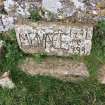
The project archive includes the spatial data and layers created during desk-based mapping and subsequent stages (TM000839-44), GPS tracks (TM000846), the metadata for the ALS processing and visualisations (WP007447), and the extent of the survey area (TM000809). More than 630 digital photographs captured during fieldwork have been added to the NRHE. Final quality assurance and review was undertaken in November and December 2020 and the project dataset was entered into the NRHE between December 2020 and March 2021.
Information from HES Survey and Recording (GFG), 7 April 2021.