Field Visit


Date 28 September 2016
Event ID 1018797
Category Recording
Type Field Visit
Permalink http://canmore.org.uk/event/1018797
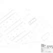
The remains of this accommodation camp are situated in woodland 200m east of the 4.7 inch gun emplacements (NS28SE 39.02) and the shore, and immediately NE of Fort Road. The original extent of the camp is depicted on a coloured and annotated copy of the 2nd edition of the Ordnance Survey 25-inch map Dumbartonshire 1898, Sheet 016.12), held in the Fort Record Book (National Archives: WO78/4396). This shows ten parallel accommodation blocks arranged in a row orientated NW and SE. Situated immediately to the NE was a guardhouse and a store, both lying perpendicular to the accommodation huts, and immediately to the SW of the row and parallel to it was another line of buildings (most of which were orientated NE and SW) which included a cookhouse, an engine-house, an oil store and latrines.
The accommodation huts each measured about 33m in length by 5.5m in breath and comprised a timber superstructure supported on six pairs of concrete pillars. All that is now visible of any of these huts are these pillars, many of them displaced, but the surviving remains indicate that even if the camp did originally contain ten accommodation huts, in its final phase there may only have been five at the most. This is because there is a 12m gap, in part defined by a broad but shallow hollow between the huts. Of the huts depicted on the plan in the Fort Record Book, there is now no trace of the three at the NW end, the sites of which either lie within what is now cultivated ground or in the margin of the wood where there has been dumping of field cleared stones. The SW end of the fourth hut from the NW survives but its NE end is missing in the cultivated ground. A broad hollow marks the position of the fifth, seventh and ninth huts. Almost all of the concrete foundation supports for the sixth and eighth huts are in situ but on the date of visit nothing was seen of the tenth in the overgrown SE margin of the wood.
Of the buildings immediately NE of the row of accommodation huts, only parts of the concrete floor of the guardhouse are now visible. Adjacent to the SW side of the guard house and perpendicular to it are the boulders footings of the SE end of a building measuring 5m in breadth that is most probably of earlier date. Of the buildings SW of the row of accommodation huts, the best preserved measures 12.6m from NE to SW by 4.5m transversely, and contains in its NE end a brick-built tower. This tower measures 2m in internal width, with a doorway and a small window in its SE end, a small window in its NW end, and a brick-built flue, possibly for a stove-pipe, in its north corner. The tower stands up to 4m in height, though its upper courses of brickwork have been removed, and it was evidently designed to hold a water tank in its upper part. There is an overflow pipe protruding from high up the external face of the NE wall and what was probably a feeder pipe runs through the SW wall into the adjacent part of the building. This part, which measures some 11.5m in length, has been reduced to its concrete floor, along both sides of which and there is a row of low, brick-built compartments, each about 1m square and of unknown depth and purpose. Doorways in middle of each side of this part of the building effectively separate these compartments, into four groups of five.
Immediately to the NW of this building there is the concrete floor of a cookhouse, which is L-shaped on plan, being broader (12m) at the SW end than on the NE (9.5m) with a re-entrant angle in its SE side. Standing 9m to the NW of the cookhouse is the raised (1m high on the SE) concrete floor of a rectangular building measuring 12.6m from NE to SW by 6.5m transversely, its W corner obscured by dumped garden waste. Immediately to the SE of the building containing the water tower there is the concrete floor of another building measuring 12m in length from NE to SW, and 6m SE of it is the largely obscured concrete floor of a ‘Kelvin’ engine-house. 7m SE of that there is the all but completely grass-grown floor of an oil store. Still further to the SE were two other buildings, including a latrines block, but only the grass-grown concrete floor of one of them, probably the latrine block, was found on the date of visit in very heavily overgrown ground.
Visited by HES Survey and Recording (JRS, AM, AKK) 28 September 2016.