|
All Other |
PBD 196/2 |
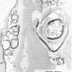
Field Survey Drawing: Early Medieval Cross-shaft, Innerleithen Parish Church |
1962 |
Item Level |
 |
On-line Digital Images |
SC 337268 |
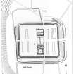
Publication drawing; plan of fort and settlements X and Y, Dreva. Photographic copy. |
c. 1958 |
Item Level |
 |
On-line Digital Images |
SC 337291 |
Publication drawing; plan of Roman fort, Lyne. Photographic copy. |
c. 1963 |
Item Level |
 |
On-line Digital Images |
SC 351362 |
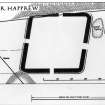
Publication drawing: plan, Roman Fort, Easter Happrew. Photographic copy. |
1962 |
Item Level |
 |
On-line Digital Images |
SC 373204 |
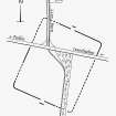
Publication drawing; plan of Roman temporary camp, Eshiels |
c. 1963 |
Item Level |
 |
On-line Digital Images |
SC 562112 |
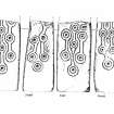
Innerleithen Parish Church, cross-shaft.
Drawing of the four sides of the cross-shaft.
Photographic copy of drawing PBD/196/1. |
c. 1962 |
Item Level |
 |
On-line Digital Images |
SC 573032 |
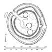
Publication drawing: Fort and Settlement, Chester Rig, Cardon. Photographic copy. |
c. 1957 |
Item Level |
 |
On-line Digital Images |
DP 006937 |
Plane-table survey: enclosed cremation cemetery, Old Deepsykehead |
7/7/1961 |
Item Level |
 |
On-line Digital Images |
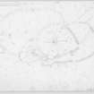
DP 043682 |
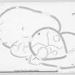
Publication drawing; fort, settlement and scooped settlement at Chester Rig |
6/1964 |
Item Level |
 |
On-line Digital Images |
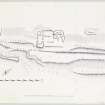
DP 043683 |
Plane-table survey: fort, settlement and scooped settlement at Chester Rig |
27/3/1963 |
Item Level |
 |
On-line Digital Images |
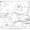
DP 071194 |
Publication drawing; site plan of tower etc, Plora Burn |
1959 |
Item Level |
 |
On-line Digital Images |
SC 1161683 |
General map showing the Roman fort, fortlet and temporary camp at Lyne and the Roman fort at Easter Happrew. |
c. 1966 |
Item Level |
 |
On-line Digital Images |
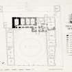
DP 096075 |
Plan of Ground Floor & Forecourt inscribed 'Traquair House'. |
12/8/1963 |
Item Level |
 |
On-line Digital Images |
DP 104229 |
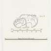
Publication drawing; Black Meldon 'Settlement and Scooped Homestead'. |
6/1964 |
Item Level |
 |
On-line Digital Images |
DP 104230 |
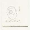
Publication drawing: 'Palisaded Homestead, South Hill Head'. |
5/1964 |
Item Level |
 |
On-line Digital Images |
DP 104232 |
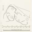
Inked plan of 'Settlement, Meldon Burn'. |
4/6/1963 |
Item Level |
 |
On-line Digital Images |
DP 104233 |
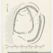
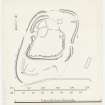
Publication drawing: settlement at Meldon Burn. |
28/2/1963 |
Item Level |
 |
On-line Digital Images |
DP 104234 |
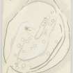
Publication drawing: settlement at South Hill Head. |
28/2/1963 |
Item Level |
 |
On-line Digital Images |
DP 104235 |
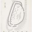
Inked plan of 'Fort, White Meldon'. |
1/1963 |
Item Level |
 |
On-line Digital Images |
DP 104197 |
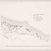
Inked plan of Black Meldon fort, traced and redrawn from the original pencil survey drawing (PBD 88/2). A reduced version appeared in RCAHMS Peebleshire 1 (1967), p101 Fig. 76. |
10/4/1964 |
Item Level |
 |
On-line Digital Images |
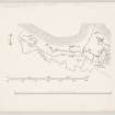
DP 156028 |
Publication Drawing: Settlement & Field Systems, Glenrath (1 of 2). |
1/7/1964 |
Item Level |
 |
On-line Digital Images |
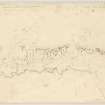
DP 156029 |
Publication Drawing: Settlement & Field System, Glenrath (2 of 2) |
1/7/1964 |
Item Level |
 |
On-line Digital Images |
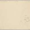
DP 156030 |
Plane Table Survey: Settlements & Field Survey, Glenrath Hope (1 of 2) |
7/4/1964 |
Item Level |
 |
On-line Digital Images |
DP 156031 |
Plane Table Survey: Settlements & Field Systems, Glenrath Hope (2 of 2) |
7/4/1964 |
Item Level |


