Archaeological site card index ('495' cards)
551 166/1/1
Description Archaeological site card index ('495' cards)
Date 1947 to 1990
Collection Records of the Ordnance Survey, Southampton, Hampshire, England
Catalogue Number 551 166/1/1
Category All Other
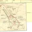
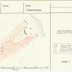
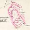
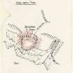
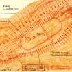
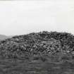
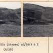
Scope and Content The ‘OS 495’ cards were one of the primary products of the revision programme undertaken by the Ordnance Survey Archaeology Division between about 1947 and 1983, and were subsequently maintained and amended by RCAHMS until 1990. The collection comprises 50 drawers, each of which holds c.1,100 cards. The cards record detailed information on the geographical and administrative location of the site, its form, condition and period. Text was entered on the record card by an OS Officer Recorder (identified by R) who prepared a summary description of the monument based on published or unpublished sources. In some instance this is succinct, in others a verbatim copy of a published description (such as a description by RCAHMS), in others still a summary of an excavation report. Each card records the date on which the summary was written and the initials of the recorder (e.g. R1 BRS 10 October 1980). These ‘desk-based assessments’ are generally followed by one or more descriptions provided by a Field Investigator (identified by an F or F.I.). These can be identified by the attribution that records the date of visit and the identity of the Investigator (e.g. ‘Visited by OS (J L D) 16 June 1971’, in this case J L Davidson). The cards also include measured sketches prepared by OS staff to aid the depiction of monuments on their maps, or to clarify interpretation. Photographs are also appended, some of which only survive as prints attached to a record card. In some cases copies of plans or photographs published elsewhere are also appended.
Administrative History Details of the origins of the Ordnance Survey’s Archaeology Division can be found in Seymour’s A History of the Ordnance Survey (1980). The work of the archaeology division grew from c.1947 and a branch was opened in Edinburgh in 1958, manned by 7 staff members. The Scottish branch of the Ordnance Survey Archaeology Division was transferred to RCAHMS in April 1983. The record cards and the associated record sheets were maintained by RCAHMS staff until 1990 when a project to transfer the text to a database was completed. This included the addition of new cards to the system (generally marked RCAHMS or National Monuments Record of Scotland) to record new discoveries, or the existence of collection material. Copies of the card index were shared widely by the OS in the 1970s to both national and local agencies and they are one of the fundamental building blocks of both Canmore and the local authority HERs in Scotland. This element of the collection comprises some 55,000 record cards with approximately 2,500 sketch surveys and 4,500 photographs attached.
Permalink http://canmore.org.uk/collection/1535334


