|
Digital Files (Non-image) |
GV 006082 |
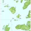
Map of the Small Isles and their location |
5/2016 |
Item Level |
|
Digital Files (Non-image) |
GV 006083 |
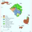
Geological map of the Small Isles |
5/2016 |
Item Level |
|
Digital Files (Non-image) |
GV 006084 |
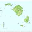
Distribution map of recorded wrecks around the Small Isles |
5/2016 |
Item Level |
|
Digital Files (Non-image) |
GV 006087 |
Plan of Creag a-Chairn. HES publication Illustration |
5/2016 |
Item Level |
|
Digital Files (Non-image) |
GV 006088 |
Plan and section of Beinn Tighe souterrain. HES publication illustration |
5/2016 |
Item Level |
|
Digital Files (Non-image) |
GV 006089 |
Plan of fort at Rubha nic Eimoin. HES publication illustration |
5/2016 |
Item Level |
|
Digital Files (Non-image) |
GV 006090 |
Plan of fort at Sean Dun. HES publication illustration |
5/2016 |
Item Level |
|
Digital Files (Non-image) |
GV 006091 |
Plan of Sgorr nam Ban-Naomha. HES publication illustration |
5/2016 |
Item Level |
|
Digital Files (Non-image) |
GV 006092 |
Plan of 'grave' at Rubha Langanes. HES publication illustration |
5/2016 |
Item Level |
|
Digital Files (Non-image) |
GV 006093 |
Plan and section of Coroghan Castle. HES publication illustration |
5/2016 |
Item Level |
|
Digital Files (Non-image) |
GV 006094 |
Plan of buildings, enclosures and cairns at Na h- Athannan. HES publication illustration |
5/2016 |
Item Level |
|
Digital Files (Non-image) |
GV 006095 |
Plan of shieling huts sitting at Blar Na Carraigh. HES publication illustration |
5/2016 |
Item Level |
|
Digital Files (Non-image) |
GV 006096 |
Plan of kelp kiln at Garrisdale. HES publication illustration |
|
Item Level |
|
Digital Files (Non-image) |
GV 006098 |
Plan of kelp kiln at Suileabhaig. HES publication illustration |
5/2016 |
Item Level |
 |
On-line Digital Images |
SC 1526606 |
Map of the Small Isles and their location. HES publication map, 400dpi copy of GV006082. |
5/2016 |
Item Level |
 |
On-line Digital Images |
SC 1526622 |
Geological map of the Small Isles. HES publication map, 400dpi copy of GV006083. |
5/2016 |
Item Level |
 |
On-line Digital Images |
SC 1526623 |
Distribution map of recorded wrecks around the Small Isles. HES publication map, 400dpi copy of GV006084. |
5/2016 |
Item Level |
 |
On-line Digital Images |
SC 1526624 |
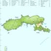
Map of Canna, showing locations mentioned in chapter. HES publication map, 400dpi copy of GV006085. |
5/2016 |
Item Level |
 |
On-line Digital Images |
SC 1526626 |
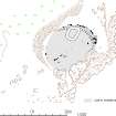
Plan of Creag a-Chairn. HES publication Illustration. HES publication illustration, 400dpi copy of GV006087. |
5/2016 |
Item Level |
 |
On-line Digital Images |
SC 1526627 |
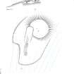
Plan and section of Beinn Tighe souterrain. HES publication illustration. HES publication illustration, 400dpi copy of GV006088. |
5/2016 |
Item Level |
 |
On-line Digital Images |
SC 1526628 |
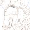
Plan of fort at Rubha nic Eimoin. HES publication illustration. HES publication illustration, 400dpi copy of GV006089. |
5/2016 |
Item Level |
 |
On-line Digital Images |
SC 1526629 |
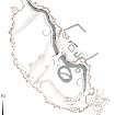
Plan of fort at Sean Dun. HES publication illustration. HES publication illustration, 400dpi copy of GV006090. |
5/2016 |
Item Level |
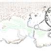 |
On-line Digital Images |
SC 1526630 |
Plan of Sgorr nam Ban-Naomha. HES publication illustration. HES publication illustration, 400dpi copy of GV006091. |
5/2016 |
Item Level |
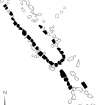 |
On-line Digital Images |
SC 1526631 |
Plan of 'grave' at Rubha Langanes. HES publication illustration. HES publication illustration, 400dpi copy of GV006092. |
5/2016 |
Item Level |


