 |
On-line Digital Images |
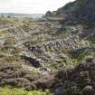
DP 228215 |
North gardens, slate spoil heaps, view from track to south west |
7/9/2015 |
Item Level |
 |
On-line Digital Images |
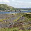
DP 228216 |
Raised track and 'sidings' (centred at NM73670 17188) to west of quarry NM71NW 115, view from north west |
7/9/2015 |
Item Level |
 |
On-line Digital Images |
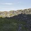
DP 228217 |
North gardens, slate spoil heaps (centred NM73731 17236), view from north west |
7/9/2015 |
Item Level |
 |
On-line Digital Images |
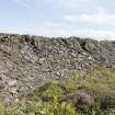
DP 228218 |
Revetment on raised track, view from south |
7/9/2015 |
Item Level |
 |
On-line Digital Images |
DP 228219 |
Revetment on raised track, view from north west |
7/9/2015 |
Item Level |
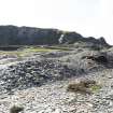 |
On-line Digital Images |
DP 228220 |
Area to south of Causeway (former tramway) between Creag Na H-Uamha quarry (NM71NW 114), and spoil at centred NM73743 17239, general view from east |
7/9/2015 |
Item Level |
 |
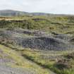
On-line Digital Images |
DP 228221 |
North gardens, slate spoil heaps centred NM73743 17239, view from north west |
7/9/2015 |
Item Level |
 |
On-line Digital Images |
DP 228222 |
North gardens, slate spoil heaps centred NM73743 17239, view from north |
7/9/2015 |
Item Level |
 |
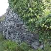
On-line Digital Images |
DP 228223 |
Structure |
7/9/2015 |
Item Level |
 |
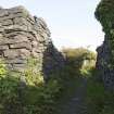
On-line Digital Images |
DP 228224 |
Remains of bridge (centred NMNM73735 17010) to North of Briar Cottage, view of west wall |
7/9/2015 |
Item Level |
 |
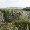
On-line Digital Images |
DP 228225 |
Remains of bridge (centred NMNM73735 17010) to north of Briar Cottage, view from north west |
7/9/2015 |
Item Level |
 |
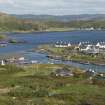
On-line Digital Images |
DP 228226 |
Elevated track (image taken from around NM73732 17002) leading to bridge to north of Briar Cottage, view from north |
7/9/2015 |
Item Level |
 |
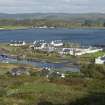
On-line Digital Images |
DP 228227 |
Harbour and east end of village, view from high ground to west |
7/9/2015 |
Item Level |
 |
On-line Digital Images |
DP 228228 |
East end of village, view from high ground to north west |
7/9/2015 |
Item Level |
 |
On-line Digital Images |
DP 228229 |
Quarries NM71NW 117, NM71NW 118 (both flooded) and NM71NW120, west track and enclosure, view from high ground to east |
7/9/2015 |
Item Level |
 |
On-line Digital Images |
DP 228230 |
Harbour and disused pier, view from high ground to west |
7/9/2015 |
Item Level |
 |
On-line Digital Images |
DP 228231 |
Harbour and disused pier, view from high ground to west |
7/9/2015 |
Item Level |
 |
On-line Digital Images |
DP 228232 |
Harbour and disused pier, view from high ground to west |
7/9/2015 |
Item Level |
 |
On-line Digital Images |
DP 228233 |
Cells |
7/9/2015 |
Item Level |
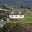 |
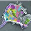
On-line Digital Images |
DP 228234 |
An Lionadh, view from high ground to north west |
7/9/2015 |
Item Level |
 |
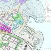
On-line Digital Images |
SC 2176656 |
Scanned copy of GV008650. Map of Easdale Island showing HES phasing survey |
10/2019 |
Item Level |
 |
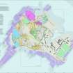
On-line Digital Images |
SC 2176606 |
Scanned copy of GV008648. Map of north-east corner of Easdale Island showing HES survey, including North spoil, walls and workings. |
10/2019 |
Item Level |
 |
On-line Digital Images |
SC 2175746 |
Scanned copy of GV008644. Map of Easdale Island showing the mapping and phasing of the HES survey, quarrying activity, tipping, internal transport and garden enclosures. |
10/2019 |
Item Level |
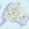 |
On-line Digital Images |
SC 2176783 |
Scanned copy of GV008651. Map of Easdale Island showing HES survey of quarries, tramways and slate distribution. |
10/2019 |
Item Level |


