Sortie 2014/07
551 178/2018/18
Description Sortie 2014/07
Collection RCAHMS Aerial Photography Digital
Catalogue Number 551 178/2018/18
Category All Other
Permalink http://canmore.org.uk/collection/1426296
Description Sortie 2014/07
Collection RCAHMS Aerial Photography Digital
Catalogue Number 551 178/2018/18
Category All Other
Permalink http://canmore.org.uk/collection/1426296
Collection Level (551 178) RCAHMS Aerial Photography Digital
> Sub-Group Level (551 178/2018) 2014 Photographs
>> Sub-Group Level (551 178/2018/18) Sortie 2014/07
| Preview | Category | Catalogue Number | Title | Date | Level |
|---|---|---|---|---|---|
| Digital Files (Non-image) | TM 000764 | GPS recorded flight path and map for Sortie 2014/07 | 19/2/2014 | Item Level | |
 |
On-line Digital Images | DP 189223 | General oblique aerial view of the River Findhorn near Clune Lodge, looking WSW. | 19/2/2014 | Item Level |
 |
On-line Digital Images | DP 189224 | General oblique aerial view of the River Findhorn near Clune Lodge, looking WSW. | 19/2/2014 | Item Level |
 |
On-line Digital Images | DP 189225 | General oblique aerial view of Tomatin Distillery, looking SW. | 19/2/2014 | Item Level |
 |
On-line Digital Images | DP 189226 | Oblique aerial view of the Isle of Moy, looking WSW. | 19/2/2014 | Item Level |
 |
On-line Digital Images | DP 189227 | Oblique aerial view of the remains of a farmstead at Moymore, looking SE. | 19/2/2014 | Item Level |
 |
On-line Digital Images | DP 189229 | General oblique aerial view of Balnafroig and Drumashie Plantation with Loch Ness beyond, looking SW. | 19/2/2014 | Item Level |
 |
On-line Digital Images | DP 189230 | General oblique aerial view of the Kessock Bridge and Caledonian Stadium Football Ground, looking NW. | 19/2/2014 | Item Level |
 |
On-line Digital Images | DP 189231 | General oblique aerial view of the Kessock Bridge and Caledonian Stadium Football Ground, looking NW. | 19/2/2014 | Item Level |
 |
On-line Digital Images | DP 189232 | General oblique aerial view of the Kessock Bridge, Caledonian Stadium and Longman Industrial Estate, Inverness, looking NW. | 19/2/2014 | Item Level |
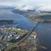 |
On-line Digital Images | DP 189233 | General oblique aerial view of the Kessock Bridge, Longman Industrial Estate and Beauly Firth, looking WNW. | 19/2/2014 | Item Level |
 |
On-line Digital Images | DP 189234 | Oblique aerial view of the site of the farmstead, looking NW. | 19/2/2014 | Item Level |
 |
On-line Digital Images | DP 189235 | General oblique aerial view of Nairn, looking NNW. | 19/2/2014 | Item Level |
 |
On-line Digital Images | DP 189236 | Oblique aerial view of the farmstead, looking W. | 19/2/2014 | Item Level |
 |
On-line Digital Images | DP 189237 | Oblique aerial view of the farmstead, looking WSW. | 19/2/2014 | Item Level |
 |
On-line Digital Images | DP 189238 | Oblique aerial view of the farmstead, looking ENE. | 19/2/2014 | Item Level |
 |
On-line Digital Images | DP 189239 | Oblique aerial view of Bogside of Boath with Boath House beyond, looking SSE. | 19/2/2014 | Item Level |
 |
On-line Digital Images | DP 189240 | Oblique aerial view of the ploughed fields at Millhill, looking SSE. | 19/2/2014 | Item Level |
 |
On-line Digital Images | DP 189243 | Oblique aerial view of the recreation ground, looking SSE. | 19/2/2014 | Item Level |
 |
On-line Digital Images | DP 189244 | Oblique aerial view of the ploughed fields at Millhill, looking NW. | 19/2/2014 | Item Level |
 |
On-line Digital Images | DP 189245 | Oblique aerial view of Bogside of Boath with Boath House beyond, looking SSW. | 19/2/2014 | Item Level |
 |
On-line Digital Images | DP 189246 | Oblique aerial view of Boath House and the ploughed fieldS beyond, looking NNW. | 19/2/2014 | Item Level |
 |
On-line Digital Images | DP 189247 | Oblique aerial view of the ploughed fields at Millhill, looking NW. | 19/2/2014 | Item Level |
 |
On-line Digital Images | DP 189248 | Oblique aerial view of Bogside of Boath, looking SSW. | 19/2/2014 | Item Level |

© Historic Environment Scotland. Scottish Charity No. SC045925