 |
On-line Digital Images |
SC 1274394 |
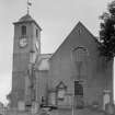
View from SW. |
|
Item Level |
 |
On-line Digital Images |
SC 1274403 |
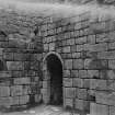
First period work in courtyard |
|
Item Level |
 |
On-line Digital Images |
SC 1331761 |
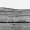
Chatto Craig cultivation remains, showing terraces separated by strips of natural hillside |
c. 1938 |
Item Level |
 |
On-line Digital Images |
SC 1331764 |
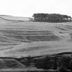
Braemoor Knowe cultivation terraces, showing combination of step-like terraces and horizontal rigs. Note faint traces of later vertical rigs in lower left.
p.s.a.s: lxxiii |
1938 |
Item Level |
 |
On-line Digital Images |
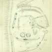
DP 158997 |
Survey drawing; plane-table plan of Edgerston fort, showing excavated areas. |
9/1938 |
Item Level |
 |
On-line Digital Images |
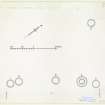
DP 228281 |
Publication drawing; plan of cairns, Whitfield. |
c. 1951 |
Item Level |
 |
On-line Digital Images |
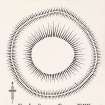
DP 228282 |
Publication drawing; plan of cairn (4), Whitfield. |
c. 1951 |
Item Level |
 |
On-line Digital Images |
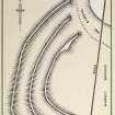
DP 228283 |
Publication drawing; plan of Earthwork, Adderstonlee. |
c. 1948 |
Item Level |
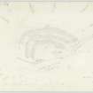 |
On-line Digital Images |
DP 228284 |
Plane-table survey; plan of fort at Adderston Lee. |
6/6/1933 |
Item Level |
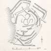 |
On-line Digital Images |
DP 228285 |
Publication drawing; plan of Earthworks, Allan Water. |
c. 1949 |
Item Level |
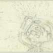 |
On-line Digital Images |
DP 228286 |
Plane-table survey; plan of Earthworks, Allan Water. |
8/8/1949 |
Item Level |
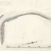 |
On-line Digital Images |
DP 228287 |
Publication drawing; plan of Earthwork, Belses Station. |
c. 1948 |
Item Level |
 |
On-line Digital Images |
DP 228288 |
Plane-table survey; plan of Earthwork, Belses Station. Surveyed 1934, checked 1948. |
25/4/1934 |
Item Level |
 |
On-line Digital Images |
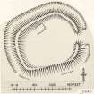
DP 228289 |
Publication drawing; plan of Earthwork at Birny Knowe. |
c. 1948 |
Item Level |
 |
On-line Digital Images |
DP 228290 |
Plane-table survey; plan of Earthwork at Birny Knowe. |
25/7/1932 |
Item Level |
 |
On-line Digital Images |
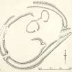
DP 228291 |
Publication drawing; plan of Earthwork, Black Hill. |
c. 1949 |
Item Level |
 |
On-line Digital Images |
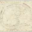
DP 228292 |
Plane-table survey; plan of Earthwork, Black Hill. |
8/5/1934 |
Item Level |
 |
On-line Digital Images |
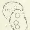
DP 228293 |
Publication drawing; plan of Settlement, Black Hill. |
c. 1947 |
Item Level |
 |
On-line Digital Images |
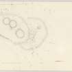
DP 228294 |
Plane-table survey; Settlement, Black Hill. |
8/1947 |
Item Level |
 |
On-line Digital Images |
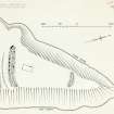
DP 228295 |
Publication drawing; plan of Earthwork, Hawkhass Linn. |
c. 1949 |
Item Level |
 |
On-line Digital Images |
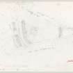
DP 228296 |
Plane-table survey; plan of Earthwork, Hawkhass Linn. |
13/6/1949 |
Item Level |
 |
On-line Digital Images |
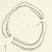
DP 228297 |
Publication drawing; plan of Earthwork, Highlee Hill. |
c. 1948 |
Item Level |
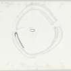 |
On-line Digital Images |
DP 228298 |
Plane-table survey; plan of Earthwork, Highlee Hill. |
10/6/1948 |
Item Level |
 |
On-line Digital Images |
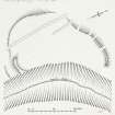
DP 228299 |
Publication drawing; Earthwork, Huntly Burn. |
c. 1948 |
Item Level |


