Sortie 2013/36
551 178/2017/20
Description Sortie 2013/36
Collection RCAHMS Aerial Photography Digital
Catalogue Number 551 178/2017/20
Category All Other
Permalink http://canmore.org.uk/collection/1348923
Description Sortie 2013/36
Collection RCAHMS Aerial Photography Digital
Catalogue Number 551 178/2017/20
Category All Other
Permalink http://canmore.org.uk/collection/1348923
Collection Level (551 178) RCAHMS Aerial Photography Digital
> Sub-Group Level (551 178/2017) 2013 Photographs
>> Sub-Group Level (551 178/2017/20) Sortie 2013/36
| Preview | Category | Catalogue Number | Title | Date | Level |
|---|---|---|---|---|---|
| Digital Files (Non-image) | TM 000838 | GPS recorded flight path and map for Sortie 2013/36 | 6/8/2013 | Item Level | |
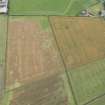 |
On-line Digital Images | DP 160673 | Oblique aerial view of the cropmarks of the enclosure and quarry pit at Plump, looking SE. | 6/8/2013 | Item Level |
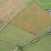 |
On-line Digital Images | DP 160674 | Oblique aerial view of the cropmarks of the enclosure and quarry pit at Plump, looking S. | 6/8/2013 | Item Level |
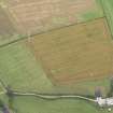 |
On-line Digital Images | DP 160675 | Oblique aerial view of the cropmarks of the enclosure and quarry pit at Plump, looking E. | 6/8/2013 | Item Level |
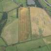 |
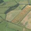
On-line Digital Images | DP 160676 | Oblique aerial view of the cropmarks of the enclosure at Floshend, looking E. | 6/8/2013 | Item Level |
 |
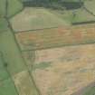
On-line Digital Images | DP 160677 | Oblique aerial view of the cropmarks of the enclosure at Floshend, looking NE. | 6/8/2013 | Item Level |
 |
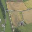
On-line Digital Images | DP 160678 | Oblique aerial view of the cropmarks of the enclosure at Floshend, looking N. | 6/8/2013 | Item Level |
 |
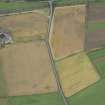
On-line Digital Images | DP 160679 | Oblique aerial view of the cropmarks of the field boudaries at Croftsheads, looking E. | 6/8/2013 | Item Level |
 |
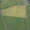
On-line Digital Images | DP 160680 | Oblique aerial view of the cropmarks of the field boundaries at Croftsheads, looking N. | 6/8/2013 | Item Level |
 |
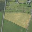
On-line Digital Images | DP 160681 | Oblique aerial view of the cropmarks of the field boundaries and plantation bank at Gasstown, looking S. | 6/8/2013 | Item Level |
 |
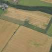
On-line Digital Images | DP 160682 | Oblique aerial view of the cropmarks of the field boundaries and plantation bank at Gasstown, looking SE. | 6/8/2013 | Item Level |
 |
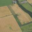
On-line Digital Images | DP 160683 | Oblique aerial view of the cropmarks of the fort at Gars Hill, looking NNW. | 6/8/2013 | Item Level |
 |
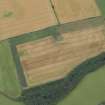
On-line Digital Images | DP 160684 | Oblique aerial view of the cropmarks of the fort at Gars Hill, looking NW. | 6/8/2013 | Item Level |
 |
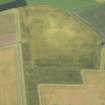
On-line Digital Images | DP 160685 | Oblique aerial view of the cropmarks of the fort at Gars Hill, looking SE. | 6/8/2013 | Item Level |
 |
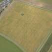
On-line Digital Images | DP 160686 | Oblique aerial view of the cropmarks of the field boundaries and drains at Dalsruscan, looking E. | 6/8/2013 | Item Level |
 |
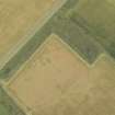
On-line Digital Images | DP 160688 | Oblique aerial view of the cropmarks of the field boundaries and drains at Dalruscan, looking NE. | 6/8/2013 | Item Level |
 |
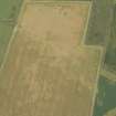
On-line Digital Images | DP 160689 | Oblique aerial view of the cropmarks of the enclosures and field boundaries at Dalruscan, looking NE. | 6/8/2013 | Item Level |
 |
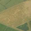
On-line Digital Images | DP 160690 | Oblique aerial view of the cropmarks of the enclosures and field boundaries at Dalruscan, looking N. | 6/8/2013 | Item Level |
 |
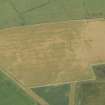
On-line Digital Images | DP 160691 | Oblique aerial view of the cropmarks of the enclosures and field boundaries at Dalruscan, looking W. | 6/8/2013 | Item Level |
 |
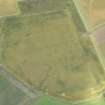
On-line Digital Images | DP 160692 | Oblique aerial view of the cropmarks of the enclosures and field boundaries at Dalruscan, looking W. | 6/8/2013 | Item Level |
 |
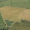
On-line Digital Images | DP 160693 | Oblique aerial view of the cropmarks of the field boundary and linear feature at Dalsruscan, looking W. | 6/8/2013 | Item Level |
 |
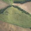
On-line Digital Images | DP 160694 | Oblique aerial view of the cropmarks of the enclosures and field boundaries at Dalruscan, looking W. | 6/8/2013 | Item Level |
 |
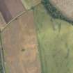
On-line Digital Images | DP 160695 | Oblique aerial view of the cropmarks of the field boundary at Holywood, looking W. | 6/8/2013 | Item Level |
 |
On-line Digital Images | DP 160696 | Oblique aerial view of the cropmarks of the field boundary at Holywood, looking SE. | 6/8/2013 | Item Level |

© Historic Environment Scotland. Scottish Charity No. SC045925