551 177/29
Description 2004 Photographs
Collection RCAHMS Aerial Photography
Catalogue Number 551 177/29
Category All Other
Permalink http://canmore.org.uk/collection/1346499
Collection Hierarchy - Sub-Group Level
Collection Level (551 177) RCAHMS Aerial Photography
> Sub-Group Level (551 177/29) 2004 Photographs
| Preview | Category | Catalogue Number | Title | Date | Level |
|---|---|---|---|---|---|
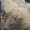 |
On-line Digital Images | SC 1751659 | Oblique aerial view centred on the remains of the fort with the remains of the scooped settlement and rig adjacent, taken from the NW. | 25/2/2004 | Item Level |
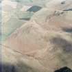 |
On-line Digital Images | SC 1751660 | Oblique aerial view centred on the remains of the fort with the remains of the scooped settlement and rig adjacent, taken from the SSW. | 25/2/2004 | Item Level |
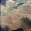 |
On-line Digital Images | SC 1751661 | Oblique aerial view centred on the remains of the fort with the remains of the scooped settlement and rig adjacent, taken from the S. | 25/2/2004 | Item Level |
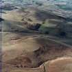 |
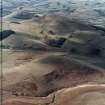
On-line Digital Images | SC 1751662 | General oblique aerial view centred on the remains of the fort with the remains of the scooped settlement and rig adjacent, taken from the ENE. | 25/2/2004 | Item Level |
 |
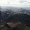
On-line Digital Images | SC 1751663 | General oblique aerial view centred on the remains of the fort with the remains of the scooped settlement and rig adjacent, taken from the ENE. | 25/2/2004 | Item Level |
 |
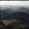
On-line Digital Images | SC 1751664 | General oblique aerial view looking over the villages of Town Yetholm and Kirk Yetholm towards the Cheviots, taken from the NNE. | 25/2/2004 | Item Level |
 |
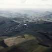
On-line Digital Images | SC 1751665 | General oblique aerial view looking over the villages of Town Yetholm and Kirk Yetholm towards the Cheviots, taken from the N. | 25/2/2004 | Item Level |
 |
On-line Digital Images | SC 1751666 | General oblique aerial view looking over the villages of Town Yetholm and Kirk Yetholm towards the Cheviots, taken from the NNW. | 25/2/2004 | Item Level |
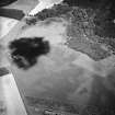 |
On-line Digital Images | SC 1751369 | Oblique aerial view centred on the cropmarks of the possible pits and enclosure, taken from the SW. | 25/6/2004 | Item Level |
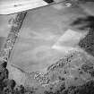 |
On-line Digital Images | SC 1751370 | Oblique aerial view centred on the cropmarks of the settlement with the cropmarks adjacent, taken from the SE. | 25/6/2004 | Item Level |
 |
On-line Digital Images | SC 1751371 | Oblique aerial view centred on the cropmarks of the possible pits and enclosure, taken from the SW. | 25/6/2004 | Item Level |
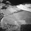 |
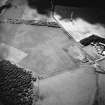
On-line Digital Images | SC 1751372 | Oblique aerial view centred on the cropmarks of the settlement with the cropmarks adjacent, taken from the E. | 25/6/2004 | Item Level |
 |
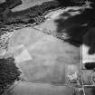
On-line Digital Images | SC 1751373 | Oblique aerial view centred on the cropmarks of the possible pits and enclosure, taken from the SW. | 25/6/2004 | Item Level |
 |
On-line Digital Images | SC 1751374 | Oblique aerial view of the cropmarks of the possible pits, possible enclosure and settlement, taken from the NE. | 25/6/2004 | Item Level |
| Photographs and Off-line Digital Images | E 12980 CN | Oblique aerial view centred on the construction of the Scottish Parliament with the exhibition centre and palace adjacent, Edinburgh | 7/6/2004 | Item Level | |
| Digital Files (Non-image) | TM 002233 | 2004 All GPS recorded flightpaths | 2004 | Item Level | |
 |
On-line Digital Images | SC 2643677 | Oblique aerial view centred on the war memorial, taken from the S. | 25/9/2004 | Item Level |
 |
On-line Digital Images | SC 2643678 | Oblique aerial view centred on the war memorial, taken from the SSE. | 25/9/2004 | Item Level |
 |
On-line Digital Images | SC 2643679 | Oblique aerial view centred on the war memorial, taken from the SSE. | 25/9/2004 | Item Level |
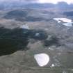 |
On-line Digital Images | SC 2703046 | General oblique aerial view of the naval gunnery range looking across Lochan nam Breac Buidhe towards Loch Airigh na Beinne and Fashven, taken from the NNE. | 28/4/2004 | Item Level |
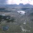 |
On-line Digital Images | SC 2703047 | General oblique aerial view of the naval gunnery range looking across Lochan nam Breac Buidhe towards Loch Airigh na Beinne and Fashven, taken from the N. | 28/4/2004 | Item Level |
 |
On-line Digital Images | SC 2703048 | Oblique aerial view of shell impact craters on the Naval Gunnery Range (c. NC 340 715), taken from the E. | 28/4/2004 | Item Level |
 |
On-line Digital Images | SC 2703049 | Oblique aerial view of shell impact craters on the Naval Gunnery Range (c. NC 340 715), taken from the E. | 28/4/2004 | Item Level |
 |
On-line Digital Images | SC 2703050 | General oblique aerial view looking across the townships towards Neave Island and Eilean nan Ron, taken from the SE. | 28/4/2004 | Item Level |


