551 177/29
Description 2004 Photographs
Collection RCAHMS Aerial Photography
Catalogue Number 551 177/29
Category All Other
Permalink http://canmore.org.uk/collection/1346499
Collection Hierarchy - Sub-Group Level
Collection Level (551 177) RCAHMS Aerial Photography
> Sub-Group Level (551 177/29) 2004 Photographs
| Preview | Category | Catalogue Number | Title | Date | Level |
|---|---|---|---|---|---|
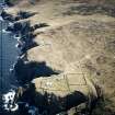 |
On-line Digital Images | SC 1676805 | Oblique aerial view centred on Cape Wrath lighthouse, keepers' cottages, cottages and support buildings with the radar station adjacent, taken from the NW. | 28/4/2004 | Item Level |
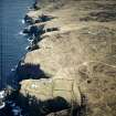 |
On-line Digital Images | SC 1676806 | Oblique aerial view centred on the lighthouse, keepers' cottages, cottages and support buildings with the radar station adjacent, taken from the NW. | 28/4/2004 | Item Level |
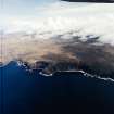 |
On-line Digital Images | SC 1676807 | General oblique aerial view of the naval gunnery range looking across Loch a' Gheodha Ruaidh towards Loch Keisgaig, taken from the WNW. | 28/4/2004 | Item Level |
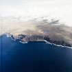 |
On-line Digital Images | SC 1676808 | General oblique aerial view of the naval gunnery range looking across Loch a' Gheodha Ruaidh towards Loch Keisgaig, taken from the WNW. | 28/4/2004 | Item Level |
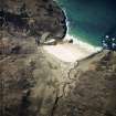 |
On-line Digital Images | SC 1676809 | Oblique aerial view centred on the remains of the buildings, field banks and enclosures, taken from the ESE. | 28/4/2004 | Item Level |
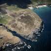 |
On-line Digital Images | SC 1676810 | Oblique aerial view centred on the remains of the radar station, taken from the E. | 28/4/2004 | Item Level |
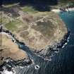 |
On-line Digital Images | SC 1676811 | Oblique aerial view centred on the remains of the radar station with caves and crofting township adjacent, taken from the ENE. | 28/4/2004 | Item Level |
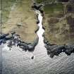 |
On-line Digital Images | SC 1676812 | Oblique aerial view centred on the Smoo cave with the remains of the radar station and crofting townships adjacent, taken from the NE. | 28/4/2004 | Item Level |
 |
On-line Digital Images | SC 1676813 | Oblique aerial view centred on the remains of the radar station with caves and crofting township adjacent, taken from the NW. | 28/4/2004 | Item Level |
 |
On-line Digital Images | SC 1676817 | General oblique aerial view centred on the crofting townships, cave and the remains of the radar station, taken from the SSE. | 28/4/2004 | Item Level |
 |
On-line Digital Images | SC 1676814 | Oblique aerial view centred on the remains of the radar station with caves and crofting townships adjacent, taken from the NW. | 28/4/2004 | Item Level |
 |
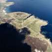
On-line Digital Images | SC 1676815 | Oblique aerial view centred on the remains of the radar station, taken from the WNW. | 28/4/2004 | Item Level |
 |
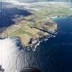
On-line Digital Images | SC 1676816 | General oblique aerial view centred on the crofting townships, cave and the remains of the radar station, taken from the SSE. | 28/4/2004 | Item Level |
 |
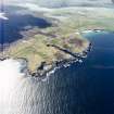
On-line Digital Images | SC 1676818 | General oblique aerial view looking across the crofting townships, cave and the remains of the radar station towards the Kyle of Durness, taken from the E. | 28/4/2004 | Item Level |
 |
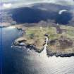
On-line Digital Images | SC 1676819 | General oblique aerial view looking across the crofting townships, cave and the remains of the radar station towards the Kyle of Durness, taken from the E. | 28/4/2004 | Item Level |
 |
On-line Digital Images | SC 1676820 | General oblique aerial view centred on the crofting townships, cave and the remains of the radar station, taken from the NNE. | 28/4/2004 | Item Level |
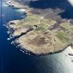 |
On-line Digital Images | SC 1676821 | General oblique aerial view centred on the crofting townships, cave and the remains of the radar station, taken from the NW. | 28/4/2004 | Item Level |
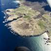 |
On-line Digital Images | SC 1676822 | General oblique aerial view centred on the crofting townships, cave and the remains of the radar station, taken from the NW. | 28/4/2004 | Item Level |
 |
On-line Digital Images | SC 1676823 | Oblique aerial view centred on the crofting township, taken from the SSW. | 28/4/2004 | Item Level |
 |
On-line Digital Images | SC 1676827 | Oblique aerial view centred on the hotel with the remains of the rig adjacent, taken from the S. | 28/4/2004 | Item Level |
 |
On-line Digital Images | SC 1676824 | Oblique aerial view centred on the remains of the radar station, taken from the WNW. | 28/4/2004 | Item Level |
 |
On-line Digital Images | SC 1676825 | Oblique aerial view centred on the remains of the radar station, taken from the W. | 28/4/2004 | Item Level |
 |
On-line Digital Images | SC 1676826 | Oblique aerial view centred on the remains of the radar station, taken from the SW. | 28/4/2004 | Item Level |
 |
On-line Digital Images | SC 1676828 | Oblique aerial view centred on the hotel with the remains of the rig adjacent, taken from the SE. | 28/4/2004 | Item Level |


