551 434/1/4
Description Colour photographs
Date 1972 to 1974
Collection Dr Colin and Dr Paula Martin
Catalogue Number 551 434/1/4
Category All Other
Permalink http://canmore.org.uk/collection/1313084
Collection Hierarchy - Sub-Group Level
Collection Level (551 434) Dr Colin and Dr Paula Martin
> Group Level (551 434/1) The Adelaar excavation.
>> Sub-Group Level (551 434/1/4) Colour photographs
| Preview | Category | Catalogue Number | Title | Date | Level |
|---|---|---|---|---|---|
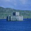 |
On-line Digital Images | SC 1313094 | Kisimul Castle, Castle Bay, Barra, seat of Roderick McNeil (1693-1763), whose response to the wrecking and its salvage highlights the complex tensions which existed between Gaeldom and 18th-century legal processes. | 1972 | Item Level |
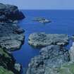 |
On-line Digital Images | SC 1313095 | of the wreck-site from the east on a rare day of flat calm. | 1972 | Item Level |
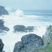 |
On-line Digital Images | SC 1313096 | The wreck-site in a Force 9 north-westerly gale, probably similar to conditions at the time of the wrecking. | 1972 | Item Level |
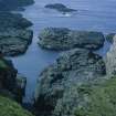 |
On-line Digital Images | SC 1313097 | The geological fault-line, which comprises the main axis of the wreck-site, running between the reef and the shore, from Gullies A and C (between the far reef and the shore) to Sloch na Frangach in the foreground. | 1972 | Item Level |
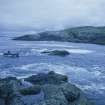 |
On-line Digital Images | SC 1313098 | Access to the site was by inflatable boat, seen here approaching Low Rock, photographed from Middle Rock. | 1972 | Item Level |
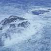 |
On-line Digital Images | SC 1313099 | Middle (foreground) and Low Rocks in heavy seas. Gully A runs below the near side of Middle Rock and its extension, Gully C, continues along the base of Low Rock. | 1972 | Item Level |
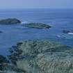 |
On-line Digital Images | SC 1313100 | The Maloch Sgeir reef complex, named on the project's site-plans as High Rock (left), Middle Rock, and Low Rock (right). | 1972 | Item Level |
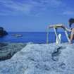 |
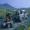
On-line Digital Images | SC 1313102 | Colin Martin conducting a improvised plane-table survey of surface features of the wreck-site on a rare calm day. The accuracy proved to be acceptable, and the result added detail and clarification to the Ordnance Survey 1:10,000 map | 1972 | Item Level |
 |
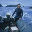
On-line Digital Images | SC 1313103 | Chris Oldfield, the original finder of the Adelaar, preparing equipment at the project base at Cliad, 2 km east of the wreck-site, from where the operations were conducted | 1972 | Item Level |
 |
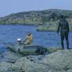
On-line Digital Images | SC 1313104 | Tony Long cons the inflatable boat through the reef system after a day's diving. The simple hand tools include buckets and shovels for excavation, and tape-measure and drawing-board for recording. | 1972 | Item Level |
 |
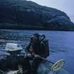
On-line Digital Images | SC 1313105 | Tony Long (in boat) and Colin Martin prepare to set out from Cliad. Most of the survey and excavation was conducted by these two diving archaeologists in 1972 and 1974. | 1972 | Item Level |
 |
On-line Digital Images | SC 1313106 | Colin Martin prepares to carry out a metal-detector survey of the wreck-site. | 1972 | Item Level |
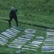 |
On-line Digital Images | SC 1313107 | Tony Long with some of the lead ingots recovered from the wreck. | 1972 | Item Level |
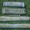 |
On-line Digital Images | SC 1313108 | The four lead-ingot types (upper sides). Scale in inches and centimetres. | 1972 | Item Level |
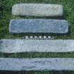 |
On-line Digital Images | SC 1313109 | The four lead-ingot types (undersides). Scale in centimetres and inches. | 1972 | Item Level |
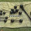 |
On-line Digital Images | SC 1313110 | A sample of iron shot recovered from the wreck-site. It includes solid iron balls of calibres suitable for 3-, 6- and 12-pounder guns, together with three examples of bar-shot (foreground) and an expanding shot (right). Scale in centimetres and inches. | 1972 | Item Level |
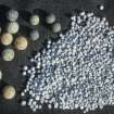 |
On-line Digital Images | SC 1313111 | Lead shot of 20-mm diameter (musket) and 13-mm diameter (pistol). Several hundred pieces of scatter-shot were also recovered, ranging from 2 to 5 mm in diameter. | 1972 | Item Level |
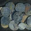 |
On-line Digital Images | SC 1313112 | Silver coins recovered from the wreck-site. Many are damaged, abraded, or otherwise illegible, but they include ducatons of the United Provinces and Spanish coins of Philip IV (1621-1665). | 1972 | Item Level |
 |
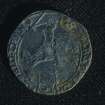
On-line Digital Images | SC 1313113 | Silver ducaton of Philip IV (44 mm diameter), Brabant mint, dated 1639. | 1972 | Item Level |
 |
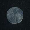
On-line Digital Images | SC 1313114 | Silver ducaton of the United Provinces (44 mm diameter), date on reverse illegible. These coins carried the mounted knight, symbol of the Dutch Republic, and were known as "riders". | 1972 | Item Level |
 |
On-line Digital Images | SC 1313115 | Obverse of a silver 1-guilder coin of the United Provinces, dated 1706. | 1972 | Item Level |
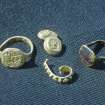 |
On-line Digital Images | SC 1313116 | Gold jewellery from the wreck-site. | 1972 | Item Level |
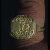 |
On-line Digital Images | SC 1313117 | Gold finger ring with a blank escutcheon set within an engraved foliate design. The escutcheon was presumably intended to contain the initials of the purchaser. | 1972 | Item Level |
 |
On-line Digital Images | SC 1313118 | Detail of gold finger ring 033 marked with the Amsterdam arms, the letters "P", DR" and a lion rampant. The maker has not been identified | 1972 | Item Level |


