|
All Other |
551 1/4/27 |
Building Survey Record Sheets |
|
Sub-Group Level |
|
All Other |
551 1/4/28 |
The Archaeological Sites and Monuments of Scotland Series |
1983 |
Sub-Group Level |
 |
Digital Files (Non-image) |
WP 007424 |
Hydro-electric power schemes notes compiled by RCAHMS volunteer George Walker in 2005 from hydro electric archive held by the former National Monuments Record of Scotland (NMRS) now known as (since October 2015) the National Record of the Historic Environment (NRHE). |
2005 |
Item Level |
 |
On-line Digital Images |
DP 172137 |
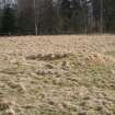
Delvine Policies. View of former golf course bunker on Inchtuthil Roman Fortress. |
14/3/2013 |
Item Level |
 |
On-line Digital Images |
SC 1228769 |
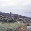
General view, taken from the N. |
4/1971 |
Item Level |
 |
On-line Digital Images |
SC 1236363 |
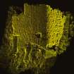
Coroghan Castle - Image of HDS scan |
|
Item Level |
 |
On-line Digital Images |
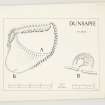
DP 154950 |
Inked plans of the fort and scooped settlement at Dunsapie. Initialled RWF. |
c. 1961 |
Item Level |
 |
On-line Digital Images |
DP 157787 |
Plane-table surveys: dun at Strathgarry; dun at Allt Druidhe. |
23/7/1962 |
Item Level |
 |
On-line Digital Images |
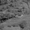
SC 1367568 |
Caisteal Grugaig from the north west. |
6/1949 |
Item Level |
 |
On-line Digital Images |
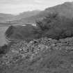
SC 1367569 |
Caisteal Grugaig from the south. |
6/1949 |
Item Level |
 |
On-line Digital Images |
DP 169561 |
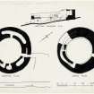
Digital image of ground plan, upper plan and section looking south east. |
c. 1949 |
Item Level |
 |
On-line Digital Images |
SC 1426790 |
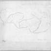
Plane-table survey: fort at Dunion Hill. Photographic copy of redrawn plan RXD 86/6. |
c. 1961 |
Item Level |
 |
On-line Digital Images |
DP 209333 |
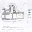
3 Lower Shader, Isle of Lewis. Phased plan. |
15/10/1975 |
Item Level |
 |
On-line Digital Images |
SC 1471985 |
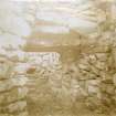
Detail of the entrance of Dun Ringill, held within a letter written from Sir John Kirk to David Christison |
1/1893 |
Item Level |
 |
On-line Digital Images |
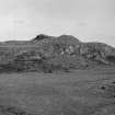
SC 1472001 |
Dun Suledale. General view. |
c. 1921 |
Item Level |
 |
On-line Digital Images |
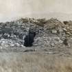
SC 1472022 |
General view of Dun Ringill, held within a letter written from SiR John Kirk to David Christison. |
c. 1892 |
Item Level |
 |
On-line Digital Images |
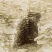
SC 1472023 |
Detail of the entrance of Dun Ringill, held within a letter written from Sir John Kirk to David Christison. |
c. 1892 |
Item Level |
 |
On-line Digital Images |
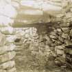
SC 1472024 |
Detail of the entrance of Dun Ringill, held within a letter written from Sir John Kirk to David Christison. |
c. 1892 |
Item Level |
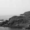 |
On-line Digital Images |
SC 1499228 |
Fort viewed from east. |
5/1983 |
Item Level |
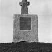 |
On-line Digital Images |
SC 1467713 |
General view. |
3/1969 |
Item Level |
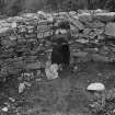 |
On-line Digital Images |
SC 2246214 |
Internal view. |
c. 1924 |
Item Level |
|
Manuscripts |
IN 626/3 |
Envelope marked 'Photos of broch (?) in Skye, Sir John Kirk to D Christison'. Contains two letters dated January 1893 and four photographic prints (IN 626/4-6). Filed with negatives. |
1/1893 |
Item Level |
|
Prints and Drawings |
RCD 23/1 |
Ground plan, upper plan and section looking south east. |
c. 1949 |
Item Level |
|
Prints and Drawings |
DC 5408 |
Plane-table survey: fort at Easter Torrie. |
7/4/1960 |
Item Level |


