|
Digital Files (Non-image) |
GV 004553 |
Cultivation terraces and banks that form part of the field system located to the W of the school house at the S end of Village Bay. |
1/2010 |
Item Level |
|
Digital Files (Non-image) |
DX 001439 |
Digital version of the Structures Database created as part of the RCAHMS Archaeological Survey of Mingulay 2003 |
2003 |
Item Level |
|
Digital Files (Non-image) |
TM 000681 |
Zip file containing survey data for the RCAHMS Survey of Mingulay. Data includes the final composite DXF file and the GPS files. |
2003 |
Item Level |
|
Digital Files (Non-image) |
GV 008465 |
Front elevation of school, Aneir |
2006 |
Item Level |
 |
On-line Digital Images |
DP 002442 |
Pen and field-system on slopes of Hecla |
6/2003 |
Item Level |
 |
On-line Digital Images |
DP 002443 |
Field survey at buildings on Hecla Point. Ian Parker, surveyor. |
6/2003 |
Item Level |
 |
On-line Digital Images |
DP 008631 |
Entrance in S side wall of building (MING03 223) in township, viewed from E. |
7/2003 |
Item Level |
 |
On-line Digital Images |
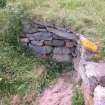
DP 008633 |
View of Chapel house and querns, from N. |
6/2003 |
Item Level |
 |
On-line Digital Images |
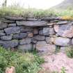
DP 008634 |
Detail of internal corner of township building, showing relieving lintel at wall head. |
6/2003 |
Item Level |
 |
On-line Digital Images |
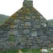
DP 008635 |
Detail of internal corner of township building, showing relieving lintel at wall head. |
6/2003 |
Item Level |
 |
On-line Digital Images |
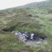
DP 008636 |
View of gable end of building (MING03 243) in township, from NE. |
6/2003 |
Item Level |
 |
On-line Digital Images |
DP 008637 |
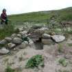
Detail of section through field bank, in Skipisdale. |
6/2003 |
Item Level |
 |
On-line Digital Images |
DP 008639 |
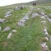
Detail of possible drain in township building (MING03 222) |
6/2003 |
Item Level |
 |
On-line Digital Images |
DP 008640 |
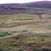
Detail of metalling on trackway between township and landing place at Aneir, from N. |
6/2003 |
Item Level |
 |
On-line Digital Images |
DP 008641 |
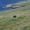
View of farmsteads and lazy beds to W of Schoolhouse, from NE |
6/2003 |
Item Level |
 |
On-line Digital Images |
DP 008642 |
View of settlement mound and building (MING03 352), from NE. |
6/2003 |
Item Level |
 |
On-line Digital Images |
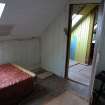
DP 008604 |
View of upstairs room in schoolhouse. |
6/3/2003 |
Item Level |
 |
On-line Digital Images |
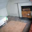
DP 008605 |
View of fireplace in upstairs room. |
6/3/2003 |
Item Level |
 |
On-line Digital Images |
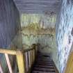
DP 008606 |
View of interior staircase. |
6/3/2003 |
Item Level |
 |
On-line Digital Images |
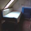
DP 008607 |
View of fireplace in upstairs room. |
6/3/2003 |
Item Level |
 |
On-line Digital Images |
DP 008608 |
View of upstairs room. |
6/3/2003 |
Item Level |
 |
On-line Digital Images |
DP 008609 |
View of upstairs landing, between two rooms. |
6/3/2003 |
Item Level |
 |
On-line Digital Images |
DP 008610 |
View of ground floor left side room. |
6/3/2003 |
Item Level |
 |
On-line Digital Images |
DP 008611 |
View of store underneath staircase. |
6/3/2003 |
Item Level |


