
Park Hill


Boundary Bank(S) (Medieval) - (Post Medieval), Rig And Furrow (Medieval) - (Post Medieval)
Site Name Park Hill
Classification Boundary Bank(S) (Medieval) - (Post Medieval), Rig And Furrow (Medieval) - (Post Medieval)
Canmore ID 166123
Site Number NY48NE 189.01
NGR NY 4700 8700
NGR Description Centred on NY 4700 8700
Datum OSGB36 - NGR
Permalink http://canmore.org.uk/site/166123


- Council Scottish Borders, The
- Parish Castleton
- Former Region Borders
- Former District Roxburgh
- Former County Roxburghshire
Field Visit (17 April 1996)
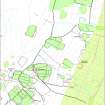
NY48NE 189.01 centred on 4700 8700
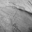
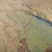
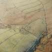
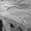
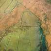
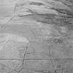
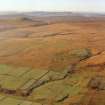
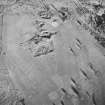
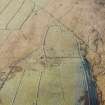
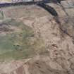
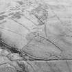
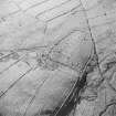
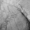
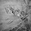
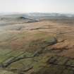
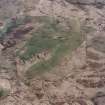
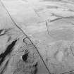
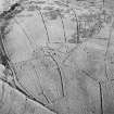
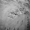
On the E side of Park Hill there is a series of boundary banks taking in large areas of both cultivated and rough ground. The banks are supplemented by ditches along the upslope, external, sides and define three successive enclosures. The largest enclosure is the earliest and the two subsequent enclosures take in smaller areas, but in each case the full extent of the earlier boundary banks may have been maintained.
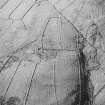
The enclosure formed by the earliest bank takes in parts of Kirk Hill and the saddle to the N, where it is overlain by fields associated with the farmstead (NY49NE 145). On the N of the Ettleton Sike the boundary bank runs up towards the summit of Park Hill, where it is overlain by cultivation defined by shallow, irregularly spaced furrows. Thereafter it runs down the NE flank of Park Hill and is cut by the line of the second boundary bank (NY 4730 8779). The line of the earlier bank and ditch can be traced for a short distance beyond this point to the E, in the vicinity of a farmstead (NY48NE 189. 02), but there is no sign that the primary bank was slighted to the W, where it lay outside the second enclosure.
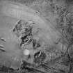
The second bank in the sequence describes a C-shape, taking in the NE flank of Park Hill. To the NE the bank is lost in a network of drains, and the E side is apparently open towards the valley floor and the Newcastleton crofts. On its NW side there is a small additional intake, formed by a bank and ditch that is butted on to the enclosure and also a building (NY48NE 189.03). At the SE end the second bank is cut by the third and final bank in the sequence of enclosure (NY 4756 8748). Beyond the intersection, within the latest enclosure, the earlier boundary can be traced for a short distance as a ploughed-out ditch, but outside, to the W, there is no evidence that it was slighted and it may have continued in use. Thus in the third phase, the different periods of enclosure may have become a single system of dykes taking in the greater part of the E flank of the hill. Further field-banks and fragmentary cultivation remains (NY48NE189.05) and the croft boundaries to the E post-date the enclosures. Traces of rig, measuring about 4m to 5m between furrows, can be seen in patches across the hill, but little evidence of cultivation has escaped levelling for the golf course.
Visited by RCAHMS (DCC) 17 April 1996

