Woodhead
Building(S) (Period Unassigned), Miners Row(S) (Period Unassigned)
Site Name Woodhead
Classification Building(S) (Period Unassigned), Miners Row(S) (Period Unassigned)
Canmore ID 106179
Site Number NX59SW 1.02
NGR NX 529 936
NGR Description Centred NX 529 936
Datum OSGB36 - NGR
Permalink http://canmore.org.uk/site/106179
- Council Dumfries And Galloway
- Parish Carsphairn
- Former Region Dumfries And Galloway
- Former District Stewartry
- Former County Kirkcudbrightshire
NX59SSW 1.02 centred 529 935
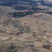
There are the remains of workers' housing, garden plots and other buildings on the E slopes of Knockower. The building remains at NX 5296 9359 are depicted as roofed and annotated as 'School' on the 1st edition of the OS 25-inch map (Kircudbrightshire 1850, sheets V and IV). The building is annotated as 'Shooting Lodge' on the 2nd edition OS 25-inch map (Kircudbrightshire 1893, sheet VII.10).
The 'Higher Row' (NX 5291 9365) and the 'Lower Row' (NX 5288 9368) are depicted as roofed and annotated on the OS 25-inch map (Kircudbrightshire 1893, sheet VII.10). There are also remains of garden plots and lazy bedding in the area of the housing. The housing was built as part of the Woodhead industrial community (1839-1873) by Colonel M. Cathcart.
Visited by RCAHMS (GJD) 30 July 1990; Information from RCAHMS (MMD) 14 August 1996; J Sassoon 1969
There are also remains of reservoirs at NX 528 940 and 'vein' workings at NX c. 527 940.
Information from Mrs Anna Campbell, Holm of Daltallochan, Castle Douglas, Kircudbrightshire.


