
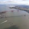
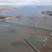
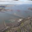
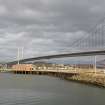
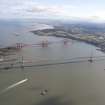
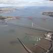
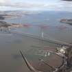
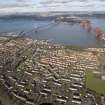
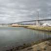
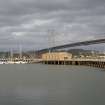
South Queensferry, Port Edgar Harbour, East Pier And Pontoons


Capstan (20th Century), Pier (First World War), Slipway (First World War)
Site Name South Queensferry, Port Edgar Harbour, East Pier And Pontoons
Classification Capstan (20th Century), Pier (First World War), Slipway (First World War)
Alternative Name(s) Hms Lochinvar
Canmore ID 136603
Site Number NT17NW 181.07
NGR NT 1210 7901
NGR Description From NT 1210 7901 to NT 1215 7869
Datum OSGB36 - NGR
Permalink http://canmore.org.uk/site/136603


- Council Edinburgh, City Of
- Parish Dalmeny
- Former Region Lothian
- Former District City Of Edinburgh
- Former County West Lothian
NT17NW 181.07 from 1210 7901 to 1215 7869
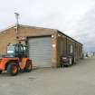
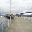
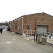
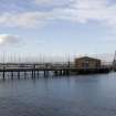
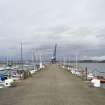
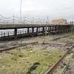
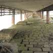
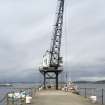
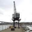
East pier situated about 150m W of the E breakwater extends N and then NW for about 300m in a dog-leg. At the NW end is an electric crane (NT17NW 181.03) and at the angle is the more recent Loop Shed (NT17NW 181.23).
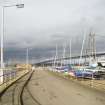
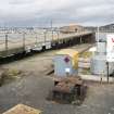
At the S end is a tracked slipway with winch to haul boats out of the water on rails still in situ. A second small bollard made by Douglas & Grant Ltd. Engineeers, Kirkcaldy survives at the S end of the slipway.
Visited by RCAHMS (DE, EL), 12 September 2006
Project (March 2013 - September 2013)
A project to characterise the quantity and quality of the Scottish resource of known surviving remains of the First World War. Carried out in partnership between Historic Scotland and RCAHMS.

