
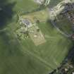
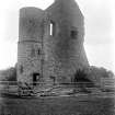
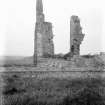
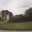
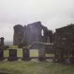
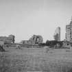
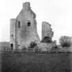
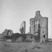
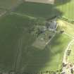
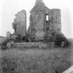
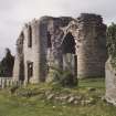
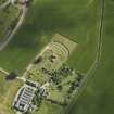
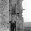
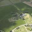
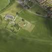
Kinloss Abbey And Burial Ground, Abbot's Lodging


Monastic Dwelling (16th Century)
Site Name Kinloss Abbey And Burial Ground, Abbot's Lodging
Classification Monastic Dwelling (16th Century)
Canmore ID 241185
Site Number NJ06SE 2.01
NGR NJ 06572 61467
Datum OSGB36 - NGR
Permalink http://canmore.org.uk/site/241185


- Council Moray
- Parish Kinloss
- Former Region Grampian
- Former District Moray
- Former County Morayshire
NJ06SE 2.01 06572 61467
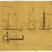
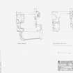
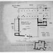
Non-Guardianship Sites Plan Collection DC23008-DC23009, 1920.
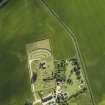
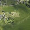
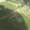
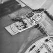
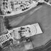
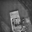
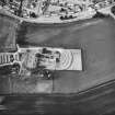
Geophysical Survey (7 July 2012)
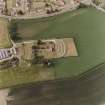
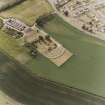
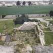
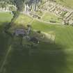
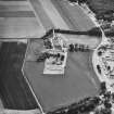
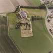
NJ 06500 61400 Earth resistance survey was undertaken over two small areas amongst the ruins of Kinloss Abbey, Moray, as part of the Rekindle Kinloss community project. A line of Electrical Resistivity Tomography data was also gathered. The Rekindle Kinloss project is a year long Heritage Lottery Funded project aimed at those aged 13 to 25. Through a variety of activities and workshops, the aim of the work is to help participants engage with their local heritage and encourage a sense of community. The geophysical survey reported here was another aspect of the project and was intended to allow the project participants a hands-on experience of collecting their own geophysical survey data. The intention was, by choosing a technique which can be undertaken by anyone with supervision, that the volunteers would be able to take ownership of the survey and by extension, of the area investigated. It was also hoped that the work, although primarily a training exercise, would produce results which aided the understanding and interpretation of the Abbey site.
Because the areas investigated were so small, interpretation of the earth resistance data is not straightforward, however, the results do suggest the presence of underlying structural material such as rubble and wall lines. The possible wall lines in Area 2 (see Figure 2) are likely to relate to the location of the Chapter House and to Cloister Walls. The results in Area 1, within the Abbots’ House (see Figure 2), are on a different orientation than the extant remains which again makes interpretation difficult. These anomalies could represent the presence of internal features or may merely be large spreads of rubble remaining within the limits of the building. The line of ERT (Electrical Resistivity Tomography) in Area 2 (see Figure 3) shows one extremely distinctive area of high resistivity and it seems most likely that this relates to an extension of the foundations of the outer cloister wall.
Information from OASIS ID: orkneyre1-514837 (M J Saunders) 2012
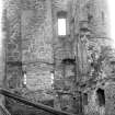
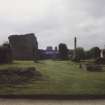
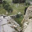
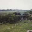
Archaeological Evaluation (5 December 2019 - 13 March 2020)
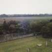
Project to stabilize two arches in north wall of abbots house, Kinloss Abby (SM1227, SMC30026620) . Limited excavation in 4 slots and one small pit under arches to support wooden frames revealed mixed modern debris with a few older finds including a single peace of green glazed ceramic and a small peace of carved marble. A watching brief was also undertake to supervise the movement of loose stone in working areas abound the structure. A number of dressed stone peaces were noted and stored on site.
Information from OASIS ID: highland4-391786 (A Young) 2020

