
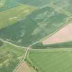
Standingstone


Settlement (Prehistoric)
Site Name Standingstone
Classification Settlement (Prehistoric)
Canmore ID 56438
Site Number NT57SE 45
NGR NT 56598 73254
Datum OSGB36 - NGR
Permalink http://canmore.org.uk/site/56438


- Council East Lothian
- Parish Morham
- Former Region Lothian
- Former District East Lothian
- Former County East Lothian
NT57SE 45 NT 56598 73254
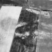
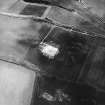
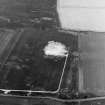
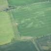
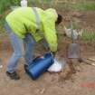
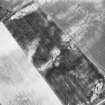
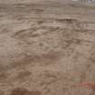
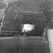
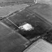
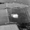
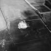
NT 5659 7325 An area ground resistance survey was conducted over part of a field that had previously been magnetically surveyed by Durham University. An area of 4800m² was surveyed, showing a high resistance oval some 60m on its long axis NE-SW. The middle of this coincides with the semi-circular mark detected by the Durham survey. The stony nature of the field at its E end and lack of clear shape in the resistivity printout could indicate that archaeology is partially masked by the geology.
Sponsors: HS, Edinburgh Archaeological Field Society, Mr A Drysdale, Mainshill Farm.
H M D Jones 2002
Geophysical Survey (August 2000 - January 2002)
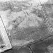
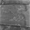
Geomagnetic surveys have been carried out over a sample of 30 cropmark sites in the vicinity of Traprain Law, comprising Phase 1 of the Traprain Law Environs Project.
In the majority of cases (23 out of 30), the surveys have confirmed the presence on the ground of the enclosures shown on aerial photographs, often with very clear results. In a number of cases, the surveys have produced evidence of probable internal and/or external features which were not immediately visible on air photographs, while in other cases, the presence of these additional features has been confirmed. Several of the sites investigated appear to represent more than one phase of archaeological activity.
In the 7 cases where cropmark sites have not been readily identified, this appears to be due to a number of factors. In only one instance does the underlying igneous geology appear to be the main factor; while in several cases, anomalies not immediately relatable to the previous cropmarks were detected and might well prove be of archaeological significance.
The work reported here brings to a conclusion Phase 1 of the Traprain Law Environs Project.
Archive to be deposited in the NMRS.
Sponsors: Historic Scotland, University of Durham, and Dickinson College, Pennsylvania.
Duncan Hale and Colin Haselgrove.
Project (2000 - 2004)
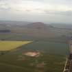
A project investigating the nature and development of later prehistoric and Roman Iron Age settlement in a 15 by 10 km block of landscape around the major fortified hilltop site at Traprain Law in East Lothian.
Archaeological Evaluation (April 2002)
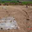
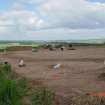
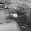
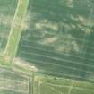
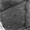
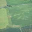
NT 5659 7325: This report presents the results of an evaluation of a curvilinear cropmark enclosure near Standingstone, East Lothian. The evaluation formed part of the wider Traprain Law Environs Project.
The aims of the evaluation were to determine the state of preservation of archaeological deposits and to obtain environmental samples and dating evidence, in order to assess the potential for larger scale excavation at a later date and to provide information of assistance in the cultural resource management of the site.
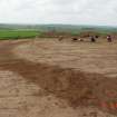
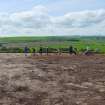
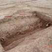
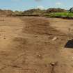
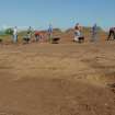
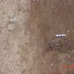
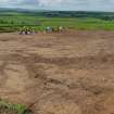
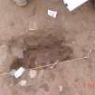
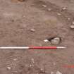
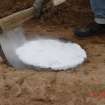
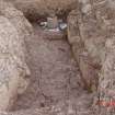
The evaluation comprised a single trench, which contained a number of features cut into the subsoil. The main enclosure ditch was excavated, as well as two internal gullies and three postholes.
Environmental samples were collected from appropriate deposits. No artefacts were recovered during the evaluation.
The site contains well-preserved archaeological deposits and has a high research potential. It would be suitable for larger scale excavation as part of the Traprain Law Environs Project.
Archive to be deposited in the NMRS.
Sponsors: Historic Scotland and University of Durham.
Duncan Hale.
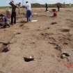
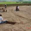
Excavation (November 2002 - July 2003)
The Traprain Law Environs Project is investigating the settlement and economy of the landscape around Traprain Law during the 1st millennia BC and AD. Since 2000, geophysical surveys have been conducted on 30 neighbouring cropmark sites, which have been followed up by a series of evaluation trenches and open-area excavations.
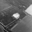
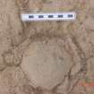
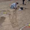
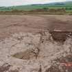
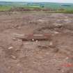
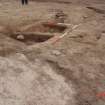
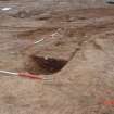
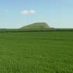
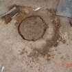
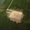
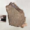
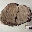
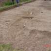
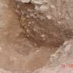
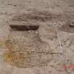
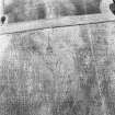
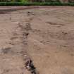
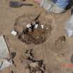
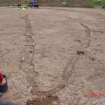
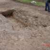
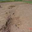
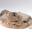
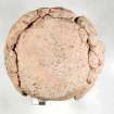
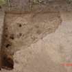
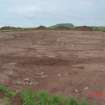
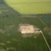
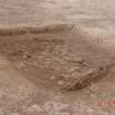
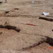
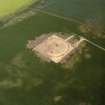
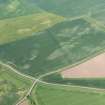
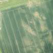
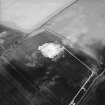
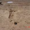
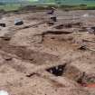
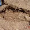
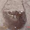
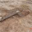
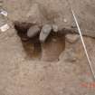
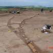
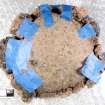
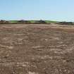
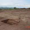
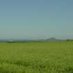
(NT 566 733) Standingstone. Enclosure situated on the end of a low ridge which extends SW from Traprain Law and overlooks lowland to the N, S and W. A geomagnetic survey of the site revealed a single oval ditch forming a partial enclosure, with a 30m break in the circuit to the NW. Excavation took place over the entirety of the enclosure, and confirmed this break in the circuit. The ditch was cut through the bedrock, and had been recut at one stage. Contemporary with the ditch were two phases of a palisade running around the interior of the ditch, which may have demarcated the interior edge of the bank. Inside the enclosure, three features with sunken cobbled surfaces were excavated (proto-souterrains), two of which were partially surrounded by curving wall gullies. A series of post-holes cut across these at a later date, perhaps blocking off the gap in the enclosure circuit.
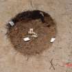
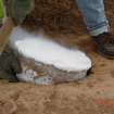
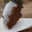
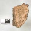
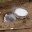
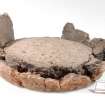
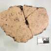
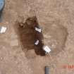
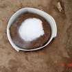
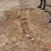
In an extension to the excavation to the E, the remains of two Bronze Age cremation vessels were recovered, their contents partially scattered by plough damage. These are likely to have been associated with a series of features across the site which pre-date the enclosure, including several fire-pits packed with charcoal and a number of post-holes. A shallow straight ditch, detected by the geomagnetic survey - perhaps an earlier field boundary - was also shown to pre-date the enclosure.
Archive to be deposited in the NMRS.
Sponsors: HS, British Academy, Society of Antiquaries of Scotland.
P Carne, D Hale and C Haselgrove 2003

