
West Mains


Linear Feature(S) (Period Unknown)
Site Name West Mains
Classification Linear Feature(S) (Period Unknown)
Alternative Name(s) Falside Castle
Canmore ID 53722
Site Number NT37SE 76
NGR NT 37645 70901
Datum OSGB36 - NGR
Permalink http://canmore.org.uk/site/53722


- Council East Lothian
- Parish Tranent
- Former Region Lothian
- Former District East Lothian
- Former County East Lothian
NT37SE 76 NT 37645 70901
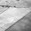
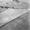
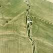
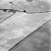
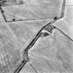
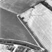
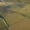
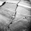
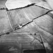
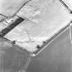
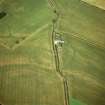
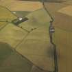
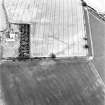
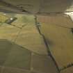
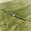
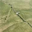
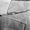
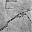
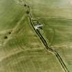
A series of linear features have been identified as cropnarks on aerial photographs across the N half of a field immediately to the W of Falside Castle (NT37SE 25). A relatively wide and irregular feature, visible from NT c.3760 7089 to NT c.3772 7091, a distance of some 115m, is intersected by a number of less distinct linear features and geological marks. A further linear cropmark has been recorded in adjacent field to the S (NT37SE 77).
Information from RCAHMS (KB) 15 December 1999.

