
Howe Mire


Colliery(S) (Industrial), Cropmark(S) (Period Unknown), Field Boundary (Period Unknown)
Site Name Howe Mire
Classification Colliery(S) (Industrial), Cropmark(S) (Period Unknown), Field Boundary (Period Unknown)
Alternative Name(s) Sweethope House
Canmore ID 53707
Site Number NT37SE 62
NGR NT 35700 71300
NGR Description Centred on NT 35700 71300
Datum OSGB36 - NGR
Permalink http://canmore.org.uk/site/53707
Ordnance Survey licence number AC0000807262. All rights reserved.
Canmore Disclaimer.
© Copyright and database right 2024.
- Correction
- Favourite

SC 1737026
Field system at Inveresk and cropmarks, coal pits and field boundary at Howe Mire.
RCAHMS Aerial Photography
23/6/1994
© Crown Copyright: HES

SC 1737722
Howe Mire, coal pits and cropmarks: oblique air photograph
RCAHMS Aerial Photography
1989
© Crown Copyright: HES

SC 1737747
Howe Mire, coal pits and cropmarks: oblique air photograph
RCAHMS Aerial Photography
1991
© Crown Copyright: HES

SC 1737748
Howe Mire, coal pits and cropmarks: oblique air photograph
RCAHMS Aerial Photography
1991
© Crown Copyright: HES

SC 1737749
Howe Mire, coal pits and cropmarks: oblique air photograph
RCAHMS Aerial Photography
1992
© Crown Copyright: HES

SC 1737771
Howe Mire, coal pits, cropmarks and field boundary: oblique air photograph
RCAHMS Aerial Photography
23/6/1994
© Crown Copyright: HES

SC 1737774
Howe Mire, coal pits, cropmarks and field boundary: oblique air photograph
RCAHMS Aerial Photography
23/6/1994
© Crown Copyright: HES

SC 1737775
Howe Mire, coal pits, cropmarks and field boundary: oblique air photograph
RCAHMS Aerial Photography
23/6/1994
© Crown Copyright: HES

SC 1737792
Howe Mire, settlement, coal pits and cropmarks: oblique air photograph
RCAHMS Aerial Photography
1992
© Crown Copyright: HES

SC 1737796
Howe Mire, oblique aerial view, taken from the NNE, centred on cropmarks which include those of a settlement and coal pits.
RCAHMS Aerial Photography
26/6/1995
© Crown Copyright: HES

SC 1737799
Howe Mire, oblique aerial view, taken from the WNW, centred on cropmarks which include those of a settlement and coal pits.
RCAHMS Aerial Photography
26/6/1995
© Crown Copyright: HES

SC 1737802
Howe Mire, oblique aerial view, taken from the ENE, centred on cropmarks which include those of a settlement and coal pits.
RCAHMS Aerial Photography
26/6/1995
© Crown Copyright: HES

SC 1737805
Howe Mire, oblique aerial view, taken from the SE, centred on the cropmarks of coal pits and a field boundary. A settlement enclosure is visible in the centre right of the photograph.
RCAHMS Aerial Photography
24/7/1995
© Crown Copyright: HES

SC 1737806
Oblique aerial view centred on the cropmarks of the settlement, cropmarks, coal pits and field boundary, taken from the E.
RCAHMS Aerial Photography
24/9/1995
© Crown Copyright: HES

SC 1737807
Howe Mire, oblique aerial view, taken from the E, centred on the cropmarks of coal pits and a field boundary. A settlement enclosure is visible in the bottom right-hand corner of the photograph.
RCAHMS Aerial Photography
24/7/1995
© Crown Copyright: HES

SC 1737811
Howe Mire, oblique aerial view, taken from the NW, showing the cropmarks of a series of coal pits in the top half of the photograph. Cropmarks of a settlement are visible in the top left-hand corner. The photograph is centred on a linear cropmark and indeterminate marks.
RCAHMS Aerial Photography
27/6/1996
© Crown Copyright: HES

SC 1737817
Oblique aerial view centred on the cropmarks of the coal pits, field boundary and further cropmarks, taken from the WNW.
RCAHMS Aerial Photography
27/7/2000
© Crown Copyright: HES

SC 1737826
Oblique aerial view centred on the cropmarks of the field boundary and further cropmarks, taken from the NE.
RCAHMS Aerial Photography
30/8/2000
© Crown Copyright: HES

SC 1737863
Howe Mire, settlement, coal sinks and cropmarks: oblique air photograph
John Dewar
1975
© HES (John Dewar Collection)

SC 2082093
Oblique aerial view showing Howe Mire, settlement, coal sinks and cropmarks.
John Dewar
1975
© HES (John Dewar Collection)

SC 2446021
Howe Mire, NT37SE 62, Ordnance Survey index card, page number 1, Recto
Records of the Ordnance Survey, Southampton, Hampshire, England
1958
© Crown Copyright: HES (Ordnance Survey Archaeology Division Collection)

SC 1737028
Field system at Inveresk and cropmarks, coal pits and field boundary at Howe Mire.
RCAHMS Aerial Photography
23/6/1994
© Crown Copyright: HES

SC 1737047
Westfield, Inveresk, oblique aerial view, taken from the NNW, centred on the cropmarks of the N terminal of the cursus monument. Cropmarks of a field-system are visible in the bottom half of the photograph.
RCAHMS Aerial Photography
27/6/1996
© Crown Copyright: HES

SC 1737309
Howe Mire and Sweethope, oblique aerial view, taken from the SE, centred on cropmarks including those of coal pits. Cropmarks of an enclosure, hut and rig are visible in the bottom right-hand corner area of the photograph.
RCAHMS Aerial Photography
26/6/1995
© Crown Copyright: HES

SC 1737311
Sweethope, oblique aerial view, taken from the E, centred on the cropmarks of an enclosure, hut and rig, and coal pits.
RCAHMS Aerial Photography
26/6/1995
© Crown Copyright: HES

SC 1737313
Howe Mire, oblique aerial view, taken from the NNE, centred on the cropmarks of coal pits, a field boundary, and a settlement.
RCAHMS Aerial Photography
24/7/1995
© Crown Copyright: HES

SC 1737328
Howe Mire, oblique aerial view, taken from the NNE, showing the cropmarks of a series of coal pits in the top half of the photograph. Cropmarks of a settlement are visible in the centre.
RCAHMS Aerial Photography
27/6/1996
© Crown Copyright: HES

SC 1737329
Howe Mire, oblique aerial view, taken from the NE, showing the cropmarks of a series of coal pits in the top half of the photograph. Cropmarks of a settlement are visible in the centre.
RCAHMS Aerial Photography
27/6/1996
© Crown Copyright: HES

SC 1737746
Howe Mire, coal pits and cropmarks: oblique air photograph
RCAHMS Aerial Photography
1991
© Crown Copyright: HES

SC 1737785
Howe Mire, cropmarks, coal pits and field boundary: oblique air photograph
RCAHMS Aerial Photography
1994
© Crown Copyright: HES

SC 1737788
Howe Mire, cropmarks, coal pits and field boundary: oblique air photograph
RCAHMS Aerial Photography
11/8/1994
© Crown Copyright: HES

SC 1737793
Howe Mire, settlement, coal pits and cropmarks: oblique air photograph
RCAHMS Aerial Photography
1992
© Crown Copyright: HES

SC 1737794
Howe Mire, oblique aerial view, taken from the S, centred on cropmarks including those of coal pits.
RCAHMS Aerial Photography
26/6/1995
© Crown Copyright: HES

SC 1737803
Howe Mire, oblique aerial view, taken from the N, showing cropmarks which include those of a settlement and coal pits in the top right-hand corner of the photograph, and an enclosure in the centre left.
RCAHMS Aerial Photography
26/6/1995
© Crown Copyright: HES

SC 1737804
Howe Mire, oblique aerial view, taken from the SSE, centred on the cropmarks of coal pits and a field boundary.
RCAHMS Aerial Photography
24/7/1995
© Crown Copyright: HES

SC 1737825
Oblique aerial view centred on the cropmarks of the field boundary and further cropmarks, taken from the E.
RCAHMS Aerial Photography
30/8/2000
© Crown Copyright: HES

SC 1737837
Oblique aerial view centred on the cropmarks of the coal-pits and field-boundary with other cropmarks, including those of the settlement, adjacent, taken from the SSW.
RCAHMS Aerial Photography
25/6/2003
© Crown Copyright: HES

SC 1737839
Oblique aerial view centred on the cropmarks of the coal-pits and field-boundary with other cropmarks including those of the settlement, the linear cropmarks, the ring-ditch, pits and rig adjacent adjacent, taken from the S.
RCAHMS Aerial Photography
25/6/2003
© Crown Copyright: HES

SC 1737860
Howe Mire, settlement, coal sinks and cropmarks: oblique air photograph
RCAHMS Aerial Photography
1979
© Crown Copyright: HES

SC 1737042
Westfield, Inveresk, oblique aerial view, taken from the WNW, centred on the cropmarks of the N terminal of the cursus monument. Cropmarks of a field-system are visible in the bottom half of the photograph.
RCAHMS Aerial Photography
27/6/1996
© Crown Copyright: HES

SC 1737280
Howe Mire, coal pits and cropmarks: oblique air photograph
RCAHMS Aerial Photography
1991
© Crown Copyright: HES

SC 1737330
Howe Mire, oblique aerial view, taken from the SE, showing the cropmarks of a series of coal pits in the centre of the photograph.
RCAHMS Aerial Photography
27/6/1996
© Crown Copyright: HES

SC 1737389
Oblique aerial view centred on the cropmarks of the ring-ditch, pits and rig with the cropmarks of the coal-pits and field-boundary adjacent, taken from the SW.
RCAHMS Aerial Photography
25/6/2003
© Crown Copyright: HES

SC 1737390
Oblique aerial view centred on the cropmarks of the ring-ditch, pits and rig with the cropmarks of the coal-pits and field-boundary adjacent, taken from the SSE.
RCAHMS Aerial Photography
25/6/2003
© Crown Copyright: HES

SC 1737397
Howe Mire, settlement, coal sinks and cropmarks: oblique air photograph
RCAHMS Aerial Photography
1979
© Crown Copyright: HES

SC 1737399
Howe Mire, settlement, coal sinks and cropmarks: oblique air photograph
John Dewar
1975
© HES (John Dewar Collection)

SC 1737403
Sweethope, enclosure, hut and rig and Howe Mire, coal sinks and cropmarks: oblique air photograph.
RCAHMS Aerial Photography
1981
© Crown Copyright: HES

SC 1737603
Oblique aerial view of coal pits, cropmarks and field boundary.
RCAHMS Aerial Photography
23/6/1994
© Crown Copyright: HES

SC 1737740
Howe Mire, coal pits and cropmarks: oblique air photograph
RCAHMS Aerial Photography
1991
© Crown Copyright: HES

SC 1737750
Howe Mire, coal pits and cropmarks: oblique air photograph
RCAHMS Aerial Photography
1992
© Crown Copyright: HES

SC 1737784
Howe Mire, cropmarks, coal pits and field boundary: oblique air photograph
RCAHMS Aerial Photography
11/8/1994
© Crown Copyright: HES

SC 1737812
Howe Mire, oblique aerial view, taken from the SSE, showing the cropmarks of a series of coal pits in the centre of the photograph.
RCAHMS Aerial Photography
27/6/1996
© Crown Copyright: HES

SC 1737820
Oblique aerial view centred on the cropmarks of the coal pits, field boundary and further cropmarks with settlement adjacent, taken from the NNE.
RCAHMS Aerial Photography
27/7/2000
© Crown Copyright: HES

SC 1737861
Howe Mire, settlement, coal sinks and cropmarks: oblique air photograph
RCAHMS Aerial Photography
1979
© Crown Copyright: HES

SC 1737866
Howe Mire, settlement, coal sinks and cropmarks: oblique air photograph
RCAHMS Aerial Photography
1981
© Crown Copyright: HES

SC 2082092
Oblique aerial view showing Howe Mire, settlement, coal sinks and cropmarks.
John Dewar
1975
© HES (John Dewar Collection)

SC 1737029
Field system at Inveresk and cropmarks, coal pits and field boundary at Howe Mire.
RCAHMS Aerial Photography
23/6/1994
© Crown Copyright: HES

SC 1737043
Pinkiehill, Inveresk, oblique aerial view, taken from the NW, centred on the cropmarks of a field-system. Cropmarks of coal pits are visible in the top half of the photograph.
RCAHMS Aerial Photography
27/6/1996
© Crown Copyright: HES

SC 1737308
Howe Mire and Sweethope, oblique aerial view, taken from the SSE, centred on cropmarks including those of an enclosure, hut, rig and coal pits.
RCAHMS Aerial Photography
26/6/1995
© Crown Copyright: HES

SC 1737401
Sweethope, enclosure, hut and rig and Howe Mire, coal sinks and cropmarks: oblique air photograph.
RCAHMS Aerial Photography
1981
© Crown Copyright: HES

SC 1737404
Sweethope, enclosure, hut and rig and Howe Mire, coal sinks and cropmarks: oblique air photograph.
RCAHMS Aerial Photography
1981
© Crown Copyright: HES

SC 1737602
Oblique aerial view of coal pits, cropmarks and field boundary.
RCAHMS Aerial Photography
23/6/1994
© Crown Copyright: HES

SC 1737605
Oblique aerial view of coal pits, cropmarks and field boundary.
RCAHMS Aerial Photography
23/6/1994
© Crown Copyright: HES

SC 1737717
Howe Mire, settlement, coal sinks and cropmarks: oblique air photograph
RCAHMS Aerial Photography
1979
© Crown Copyright: HES

SC 1737786
Howe Mire, cropmarks, coal pits and field boundary: oblique air photograph
RCAHMS Aerial Photography
11/8/1994
© Crown Copyright: HES

SC 1737787
Howe Mire, cropmarks, coal pits and field boundary: oblique air photograph
RCAHMS Aerial Photography
1994
© Crown Copyright: HES

SC 1737795
Howe Mire, oblique aerial view, taken from the NE, centred on cropmarks which include those of a settlement, and coal pits.
RCAHMS Aerial Photography
26/6/1995
© Crown Copyright: HES

SC 1737800
Howe Mire, oblique aerial view, taken from the N, centred on cropmarks which include those of a settlement and coal pits.
RCAHMS Aerial Photography
26/6/1995
© Crown Copyright: HES

SC 1737823
Oblique aerial view centred on the cropmarks of the coal pits, field boundary and further cropmarks, taken from the S.
RCAHMS Aerial Photography
27/7/2000
© Crown Copyright: HES

SC 1737862
Howe Mire, settlement, coal sinks and cropmarks: oblique air photograph
RCAHMS Aerial Photography
1979
© Crown Copyright: HES

SC 1737864
Howe Mire, settlement, coal sinks and cropmarks: oblique air photograph
John Dewar
1975
© HES (John Dewar Collection)

SC 2082094
Oblique aerial view showing Howe Mire, settlement, coal sinks and cropmarks.
John Dewar
1975
© HES (John Dewar Collection)

SC 2446022
Howe Mire, NT37SE 62, Ordnance Survey index card, Recto
Records of the Ordnance Survey, Southampton, Hampshire, England
1958
© Crown Copyright: HES (Ordnance Survey Archaeology Division Collection)

SC 1737027
Field system at Inveresk and cropmarks, coal pits and field boundary at Howe Mire.
RCAHMS Aerial Photography
23/6/1994
© Crown Copyright: HES

SC 1737046
Westfield, Inveresk, oblique aerial view, taken from the SSE, centred on the cropmarks of the N terminal of the cursus monument. Cropmarks of a field-system are visible in the centre of the photograph.
RCAHMS Aerial Photography
27/6/1996
© Crown Copyright: HES

SC 1737723
Howe Mire, coal pits and cropmarks: oblique air photograph
RCAHMS Aerial Photography
1989
© Crown Copyright: HES

SC 1737773
Howe Mire, coal pits, cropmarks and field boundary: oblique air photograph
RCAHMS Aerial Photography
23/6/1994
© Crown Copyright: HES

SC 1737801
Howe Mire, oblique aerial view, taken from the E, centred on cropmarks which include those of a settlement and coal pits.
RCAHMS Aerial Photography
26/6/1995
© Crown Copyright: HES

SC 1737818
Oblique aerial view centred on the cropmarks of the coal pits, field boundary and further cropmarks with hotel and public house adjacent, taken from the NW.
RCAHMS Aerial Photography
27/7/2000
© Crown Copyright: HES

SC 1737824
Oblique aerial view centred on the cropmarks of the coal pits, field boundary and further cropmarks, taken from the SSW.
RCAHMS Aerial Photography
27/7/2000
© Crown Copyright: HES

SC 1737327
Howe Mire, oblique aerial view, taken from the NNE, showing the cropmarks of a series of coal pits in the top half of the photograph. Cropmarks of a settlement are visible in the centre.
RCAHMS Aerial Photography
27/6/1996
© Crown Copyright: HES

SC 1737332
Howe Mire, oblique aerial view, taken from the ESE, showing the cropmarks of a series of coal pits in the centre of the photograph.
RCAHMS Aerial Photography
27/6/1996
© Crown Copyright: HES

SC 1737402
Sweethope, enclosure, hut and rig and Howe Mire, coal sinks and cropmarks: oblique air photograph.
RCAHMS Aerial Photography
1981
© Crown Copyright: HES

SC 1737631
Howe Mire, cropmarks, coal pits and field boundary: oblique air photograph
RCAHMS Aerial Photography
11/8/1994
© Crown Copyright: HES

SC 1737686
Howe Mire, oblique aerial view, taken from the SSW, showing the cropmarks of a series of coal pits in the bottom half of the photograph. Cropmarks of a settlement are visible in the centre right.
RCAHMS Aerial Photography
27/6/1996
© Crown Copyright: HES

SC 1737772
Howe Mire, coal pits, cropmarks and field boundary: oblique air photograph
RCAHMS Aerial Photography
23/6/1994
© Crown Copyright: HES

SC 1737797
Howe Mire, oblique aerial view, taken from the NNW, centred on cropmarks which include those of a settlement and coal pits.
RCAHMS Aerial Photography
26/6/1995
© Crown Copyright: HES

SC 1737809
Howe Mire, oblique aerial view, taken from the SSW, centred on the cropmarks of a series of coal pits. Cropmarks of a settlement are visible in the top right-hand corner of the photograph.
RCAHMS Aerial Photography
27/6/1996
© Crown Copyright: HES

SC 1737810
Howe Mire, oblique aerial view, taken from the WSW, centred on a linear cropmark and indeterminate marks. Further cropmarks of a series of coal pits are visible in the top right-hand corner of the photograph.
RCAHMS Aerial Photography
27/6/1996
© Crown Copyright: HES

SC 1737813
Howe Mire, oblique aerial view, taken from the E, showing the cropmarks of a series of coal pits in the centre of the photograph.
RCAHMS Aerial Photography
27/6/1996
© Crown Copyright: HES

SC 1737842
Oblique aerial view centred on the cropmarks of the coal-pits and field-boundary with other cropmarks adjacent, taken from the NE.
RCAHMS Aerial Photography
25/6/2003
© Crown Copyright: HES

SC 1737867
Howe Mire, settlement, coal sinks and cropmarks: oblique air photograph
RCAHMS Aerial Photography
1981
© Crown Copyright: HES

SC 1737307
Howe Mire, settlement, coal pits and cropmarks: oblique air photograph
RCAHMS Aerial Photography
1992
© Crown Copyright: HES

SC 1737604
Oblique aerial view of coal pits, cropmarks and field boundary.
RCAHMS Aerial Photography
23/6/1994
© Crown Copyright: HES

SC 1737721
Howe Mire, coal pits and cropmarks: oblique air photograph
RCAHMS Aerial Photography
1989
© Crown Copyright: HES

SC 1737741
Howe Mire, coal pits and cropmarks: oblique air photograph
RCAHMS Aerial Photography
1991
© Crown Copyright: HES

SC 1737789
Howe Mire, cropmarks, coal pits and field boundary: oblique air photograph
RCAHMS Aerial Photography
1994
© Crown Copyright: HES

SC 1737790
Howe Mire, cropmarks, coal pits and field boundary: oblique air photograph
RCAHMS Aerial Photography
11/8/1994
© Crown Copyright: HES

SC 1737791
Howe Mire, settlement, coal pits and cropmarks: oblique air photograph
RCAHMS Aerial Photography
1992
© Crown Copyright: HES

SC 1737798
Howe Mire, oblique aerial view, taken from the NW, centred on cropmarks which include those of a settlement and coal pits.
RCAHMS Aerial Photography
26/6/1995
© Crown Copyright: HES

First 100 images shown. See the Collections panel (below) for a link to all digital images.
- Council East Lothian
- Parish Inveresk (East Lothian)
- Former Region Lothian
- Former District East Lothian
- Former County Midlothian
NT37SE 62 centred on NT 35700 71300
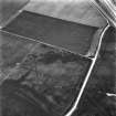
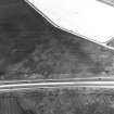
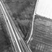
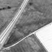
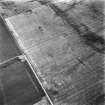
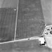
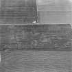
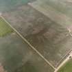
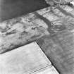
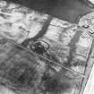
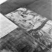
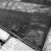
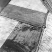
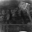
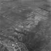
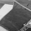
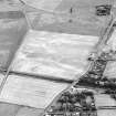
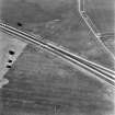
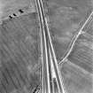
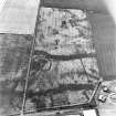
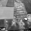
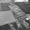
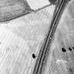
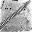
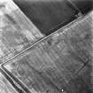
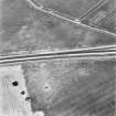
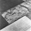
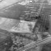
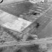
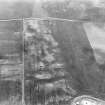
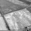
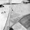
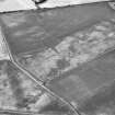
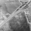
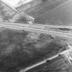
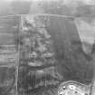
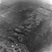
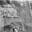
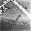
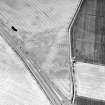
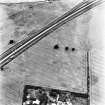
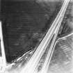
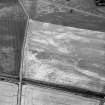
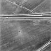
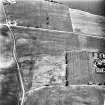
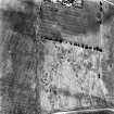
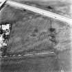
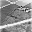
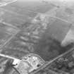
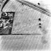
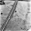
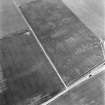
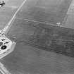
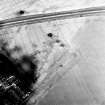
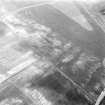
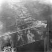
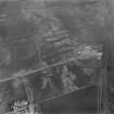
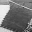
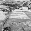
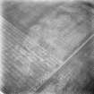
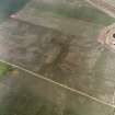
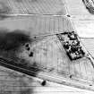
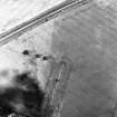
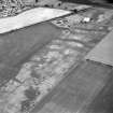
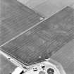
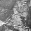
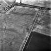
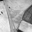
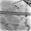
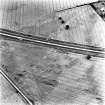
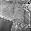
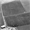
NT 357 713. Coal Sinks and Cropmarks, Howe Mire: visible on aerial photographs.
(Undated) information in NMRS.
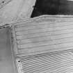
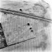
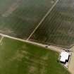
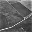
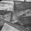
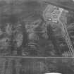
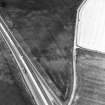
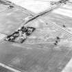
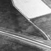
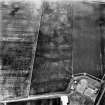
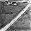
An old field boundary to the NE of Sweethope House has been recorded by aerial photography (RCAHMSAP 1994) and is depicted on the 1st edition of the OS 6-inch map (Edinburghshire, 1854, sheet 7).
Information from RCAHMS (GJW) 17 December 1997.
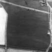
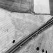
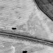
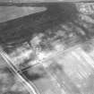
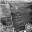
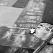
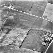
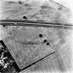
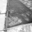
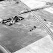
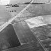
Two broad lines of coal pits have been recorded as cropmarks alongside further indeterminate cropmarks on oblique aerial photography (RCAHMSAP 1979, 1981, 1989, 1991, 1992, 1994, 1995, 1996, 2000) lying on the gently sloping ground of Howe Mire. The field boundary lies towards the S.
Information from RCAHMS (KMM) 16 August 2004

