
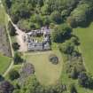
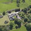
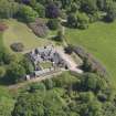
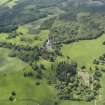
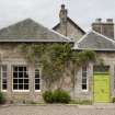
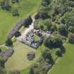
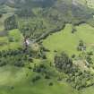
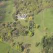
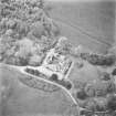
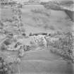
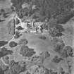
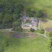
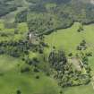
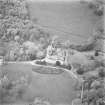
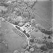
Blair Adam


Country House (18th Century)
Site Name Blair Adam
Classification Country House (18th Century)
Alternative Name(s) Blairadam; Blair Adam Policies
Canmore ID 51063
Site Number NT19NW 26
NGR NT 12929 95700
Datum OSGB36 - NGR
Permalink http://canmore.org.uk/site/51063


First 100 images shown. See the Collections panel (below) for a link to all digital images.
- Council Perth And Kinross
- Parish Cleish
- Former Region Tayside
- Former District Perth And Kinross
- Former County Kinross-shire
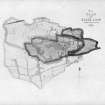
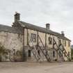
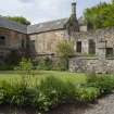
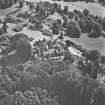
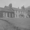
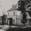
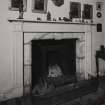
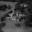
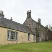
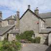
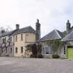
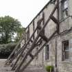
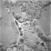
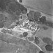
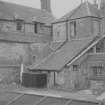
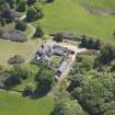
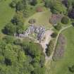
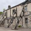
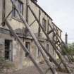
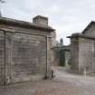
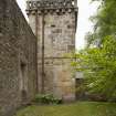
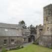
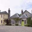
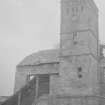
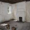
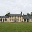
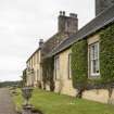
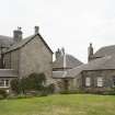
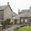
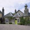
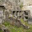
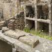
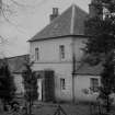
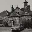
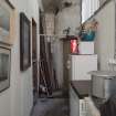
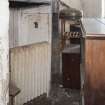
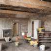
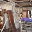
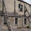
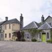
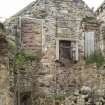
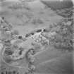
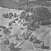
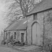
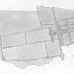
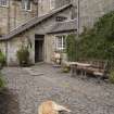
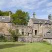
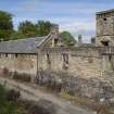
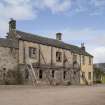
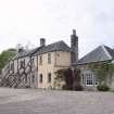
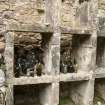
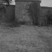
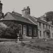
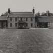
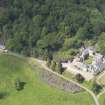
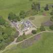
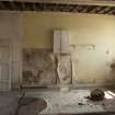
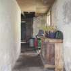
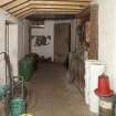
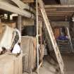
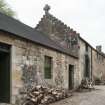
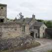
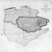
The south wing of Blair Adam was recorded by RCAHMS Threatened Buildings Survey in June 2013 prior to proposed partial demolition of the wing that has been propped up with timber buttresses designed by Roland Wedgewood. The remaining portuion of the wing is to be developed as a study centre for the Adam Family archives. It is proposed to develop the partially ruinous notheast corner of the courtyard as two holiday houses this area was also recorded. The opportunity was also taken to photograph the exterior of the whole house.
STG 2014
NT19NW 26.00 12929 95700
NT19NW 26.00 12929 95700
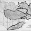
NT19NW 26.01 13179 95971 Walled Garden and Adam Monument (Centred on)
NT19NW 63 14209 95910 Blairfordel Lodge
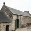
NT19NW 18 1305 9526 East Lodge
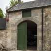
NT19NW 19 12791 95616 Coach House
NT19NW 20 13022 96035 North Blair
NMRS REFERENCE
Architect: William Adam, from 1733.
Robert Adam, additions 1772. Designs in Vol 45 of Soane Museum drawings - not executed.
EXTERNAL REFERENCE:
John Adam's drawing instruments, two sets and their cases
in the collection of Keith Adam at Blair Adam - B00155, B00156, B00172 and B00174/CN
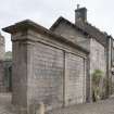
Standing Building Recording (May 2015 - September 2015)
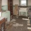
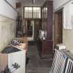
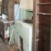
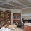
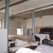
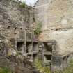
NT 12929 95700 A standing building survey was undertaken, May – September 2015, of the derelict and part demolished south range of Blair Adam House. A watching brief was also undertaken during the demolition of the unstable 19th-century range.
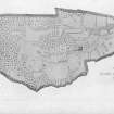
The stripping and demolition of the range allowed the creation of a more refined set of phase plans and elevations, broadly confirming the earlier phasing of the structure, which was based on historical documents and analysis of the building in the 1990s.
The structure was originally constructed at the beginning of the 19th century and has seen an extensive series of modifications to the physical structure and use of its interior space. The last major phase was in the early 20th century, with dilapidation and collapse of the structure in the later 20th century. The range is to be rebuilt to securely store the archive of original Adam family documents held on site.
Archive: NRHE
Funder: K and E Adam
Kenneth Macfadyen – Addyman Archaeology
(Source: DES, Volume 17)

