
Carlops, Spittal


Rig And Furrow (Medieval) - (Post Medieval), Temporary Camp(S) (Roman)
Site Name Carlops, Spittal
Classification Rig And Furrow (Medieval) - (Post Medieval), Temporary Camp(S) (Roman)
Canmore ID 50170
Site Number NT15NE 30
NGR NT 1715 5725
NGR Description Centred NT 1715 5725
Datum OSGB36 - NGR
Permalink http://canmore.org.uk/site/50170


- Council Midlothian
- Parish Penicuik (Midlothian)
- Former Region Lothian
- Former District Midlothian
- Former County Midlothian
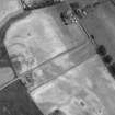
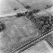
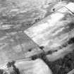
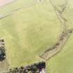
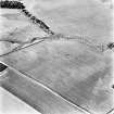
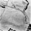
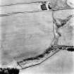
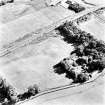
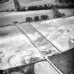
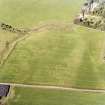
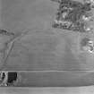
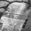
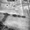
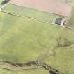
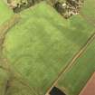
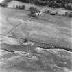
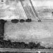
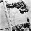
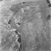
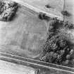
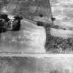
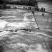
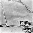
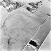
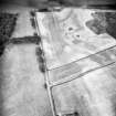
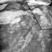
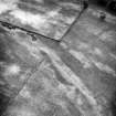
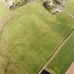
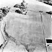
Large camp has only one entrance so far identified; titulate and central in NE side. Reducing-ditches visible at each end of the interior may have served to reduce the size to about 12.5 ha in a secondary phase. This is probably the 'Roman excampment' noted by Alexander Gordon near Romanno.
G S Maxwell and D R Wilson 1987.
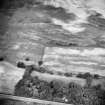
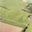
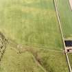
Aerial reconnaissance (in 1996) has revealed an annexe extending to the NE of the camp, N of the known titulum. It measures about 120m in length by 70m in width.
Information from RCAHMS (RHM) 16 May 1997.
Note (1988)
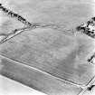
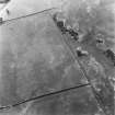
Spittal, Temporary Camps NT 171 572 NT15NE 30
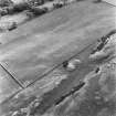
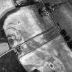
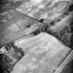
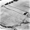
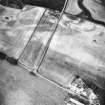
Air survey has revealed the cropmarks of at least one, and probably two, temporary camps 450m SSE of Spittal steading. Trial trenching in 1985 showed that the larger encloses about 16.9ha and appears to pre-date the Roman road that runs along the SE flank of the Pentlands.
RCAHMS 1988
(Frere 1986, 371)
Aerial Photographic Transcription (14 March 1997 - 29 March 1997)
An aerial transcription was produced from oblique aerial photographs. Information from Historic Environment Scotland (BM) 31 March 2017.
Publication Account (17 December 2011)
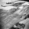
First recorded in 1984 by RCAHMS from the air (Frere 1986), this camp lies on a ridge above the village of Carlops, on sloping ground on the south-east side of the Pentland Hills. The full extent of the cropmarks suggest that the camp measured about 672m from north-east to southwest by 272m transversely, enclosing 18.8ha (46 acres). There appears to be a titulus close to the centre of the north-east side. Excavations by Maxwell in 1985 revealed that the ditch was about 2.8m wide and about 1m deep on the lower ground (Frere 1986: 371).
An annexe was recorded in 1996, extending from the north-east part of the camp and overlapping with a settlement enclosure (not depicted on illus 96). This annexe is elongated, measuring some 122m to the northeast by 71m, thereby enclosing an additional 0.86ha (2.1 acres).
Two linear cropmarks, located 85m from the northeast and 90m from the south-west ends suggest that the camp has been reduced on at least one occasion. These two may be contemporary with each other, or represent two phases of reduction or increase in the size of the camp. This second camp may be only 473m in length if the two linear cropmarks bisecting the first are contemporary and relate to a reduction in the size of the camp, only reusing stretches of the north-west and south-east sides. This would result in a camp of some 14ha (35 acres). No entrances are known.
R H Jones

