
Castle Hill, Durris


Motte (Medieval)
Site Name Castle Hill, Durris
Classification Motte (Medieval)
Alternative Name(s) Castle Of Dores; Castlehill
Canmore ID 36623
Site Number NO79NE 1
NGR NO 7796 9680
Datum OSGB36 - NGR
Permalink http://canmore.org.uk/site/36623


- Council Aberdeenshire
- Parish Durris
- Former Region Grampian
- Former District Kincardine And Deeside
- Former County Kincardineshire
NO79NW 1 7796 9680.
(NO 7797 9681) Castle (NR) (Site of)
OS 6" map, Kincardine, (1928)
The Castle of Dores stood on the south bank of the Dee, upon a rising ground, or rather a conical Knoll. The site appears to have been moated and the castle itself was burned by the Marquis of Montrose (1645) but no record or tradition ot it remains in the district, except the significant "Castle Hill". It was occupied as a residence by Alexander III , and the earliest mention of it occurs in the Chamberlain Rolls of that period, when certain sums of money were paid for repairs to...the vessels and bridge at the house of Durres (information from the Chamberlain Rolls) but whether the bridge was of stone or wood is not recorded - it may have been a draw bridge for the castle. King Edward I visited the castle in 1296.
A Jervise 1861.
The Castle of Dores was a hunting seat of considerable strength.
J A Henderson 1892.
'Durris' was a royal residence and park as early as the reign of Alexander III...No remains of the old Castle of Durris exist.
(Undated) information in NMRS.
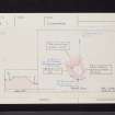
There is no trace of stone footings representing a castle on top of Castle Hill - a wooded knoll. The hill is flat-topped with steep slopes which may have been steepened artificially on three sides. On the SW side where the natural slopes are insubstantial, a ditch, 2.6m deep , has been constructed, but this has been partially filled by stones from the adjoining field. The E. slopes have been mutilated by quarrying and the addition of rubbish. No entrance is visible. The name "Castle Hill" is still known locally. This feature is probably a motte.
Re-surveyed at 1/2500.
Visited by OS (NKB) 6 January 1965.
This motte (also known as the Castle of Dores) has been formed from a natural mound. It stands to a height of 7m on the S, but on the N its sides fall steeply towards the River Dee; the level summit of the mound measures 41m by 30m, and around its base on the W there are the remains of a broad ditch. The 'house of Durres' is on record in the 13th century.
RCAHMS 1984, visited January 1983.
New Statistical Account (NSA) 1845; A Jervise 1861.
Listed.
Scottish Castle Survey 1988; N Bogdan and I B D Bryce 1991.

