
Balcathie


Cropmark(S) (Period Unknown), Enclosure (Period Unassigned), Pit Enclosure (Prehistoric)(Possible), Rig And Furrow (Medieval), Souterrain(S) (Prehistoric)(Possible)
Site Name Balcathie
Classification Cropmark(S) (Period Unknown), Enclosure (Period Unassigned), Pit Enclosure (Prehistoric)(Possible), Rig And Furrow (Medieval), Souterrain(S) (Prehistoric)(Possible)
Canmore ID 35375
Site Number NO63NW 11
NGR NO 605 392
Datum OSGB36 - NGR
Permalink http://canmore.org.uk/site/35375


- Council Angus
- Parish Arbirlot
- Former Region Tayside
- Former District Angus
- Former County Angus
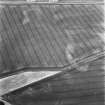
NO63NW 11 605 392.
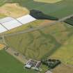
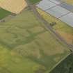
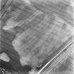
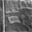
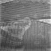
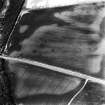
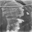
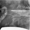
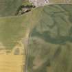
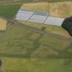
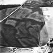
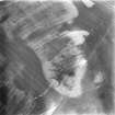
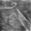
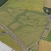
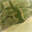
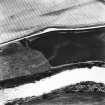
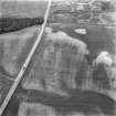
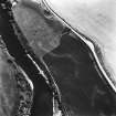
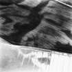
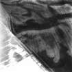
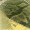
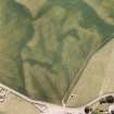
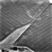
Cropmarks including those of two enclosures and possible souterrains have been identified on aerial photographs 350m NE of Cotton of Balcathie. An oval enclosure, measuring about 20m by 9m internally, has a ditch of maximum width 4m on its W half (NO 6060 3935), with a series of possible souterrains 45m to the SSW. In the same field, three sides of what may be a rectilinear pit-defined enclosure, 18m by at least 7m, is visible at NO c.6055 3921, with a possible entrance in the centre of the NE side. Indeterminate marks, many of them geological, have also been recorded in this area. Patches of rig and furrow cultivation intersect the cropmarks in this field and the fields adjacent to it. Further cropmarks, including those of ring-ditches and pit features (NO63NW 3) have been recorded 100m to the S.
Information from RCAHMS (KB) 12 April 1999

