
Edinburgh, Landward Defences


Loopholed Wall(S) (First World War), Machine Gun Post(S) (First World War), Trench(S) (First World War)
Site Name Edinburgh, Landward Defences
Classification Loopholed Wall(S) (First World War), Machine Gun Post(S) (First World War), Trench(S) (First World War)
Alternative Name(s) Seafield; Duddingston; Prestonfield; Cameron Toll; Craigmillar Park Golf Course; Liberton Tower; Mortonhall
Canmore ID 332077
Site Number NT27SE 6127
NGR NT 27386 72247
Datum OSGB36 - NGR
Permalink http://canmore.org.uk/site/332077

- Council Edinburgh, City Of
- Parish Edinburgh (Edinburgh, City Of)
- Former Region Lothian
- Former District City Of Edinburgh
- Former County Midlothian
NT27SE 6127.00 centred on 27386 72247
NT27SE 6127.01 From NT 29408 75354 to NT 28370 72542 Trenches
NT27SE 6127.02 From NT 27958 72585 to NT 27000 70734 Trenches; Machine Gun Post
NT27SE 6127.03 From NT 26984 70774 to NT 26142 68738 Trenches
A series of War Department maps dated 1916 (The National Archives WO 78/4396) shows the location of a complex of defences protecting Edinburgh from attack from the east. The defences comprised barbed wire entanglements, firing trenches (some of considerable size and complexity) and loopholed walls. Some of the firing positions were approached from the rear by complex communication trenches. The defences ran from the coast at Seafield, to Duddingston and round the south side of Holyrood Park, to Craigmillar, to Liberton Tower, and ending just north of Mortonhall. The northernmost section of the defence, at Seafield, had a forward line of defence to its east, at Craigentinny. Organisationally, the defence was split into 3 Sections. Section 1 covered Seafield to Duddingston. Section 2 Duddingston Loch to just south of the Braid Burn, and Section 3 from there to the southern terminal.
On map NT27SE (continuing onto NT37SW and NT27NE), Section 1 of the Edinburgh defences were in two parts. Inland, a single line of barbed wire entanglement continued southward for about 670m to a farm named Wheatfield on Portobello Road. At NT 2928 7482 there was a major firing position and in this sector a second line of barbed wire entanglement reinforced the barrier. The barrier resumed on the southern side of the railway lineand ran SW and SSW to Willowbrae Road, in part as a double line of wire. There was a complex firing position on the east side of Willowbrae Road.
South-west of Willowbrae Road the entanglement continued for a further 750m across what was then open ground, to Duddingston. For much of this stretch the barbed wire had a near-continuous trench behind it (made up of firing positions and communication trenches). The eastern side of Duddingston was furnished with loopholed walls and firing trenches, with a line of barbed wire closing the gap between the village and Duddingston Loch. This marked the SW end of Section 1 of the Edinburgh defences.
On the coast, a barbed wire entanglement continued past what was then The Edinburgh Marine Gardens. The main entanglement turned inland to Seafield Road while a subsidiary entanglement continued along the coast, to the NE end of King’s Road. Where the entanglement turned inland, there was a complex firing trench running for some 370m round the corner. The junction of Portobello Road and Portobell High Street was covered to the SE by barbed wire, which also protected the front of the Ramsay Technical Institute (NT27SE 5107). The barbed wire entanglement and firing and communication trenches continued SW to the railway. This was the end of the forward line of defence.
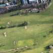
Section 2 of the Edinburgh defences started at the west end of Duddingston Loch and ran, as a double line of barbed wire entanglement, across what is now Prestonfield golf course. Behind (west of) the inner line were complex firing positions with communications trenches and, near the western end of the drive to Prestonfield House, a fortification labelled ‘Prestonfield Redoubt’.
The entanglement continued southwards, behind the tenements of Dalkeith Road, with a continuous firing trench behind it. There were firing trenches in Newington Cemetery and the barbed wire resumed on the SW side of the railway line, covering the front of the United Free Church in Suffolk Gardens (NT27SE 3829), which was the Section Commander’s HQ. The stone wall along the south side of Lady Road was loopholed. Firing positions were placed along Hallhead Road, at that time the southern edge of building. This marked the SW end of Section 2 of the defences. The Section HQ was at Piershill Barracks, and the map shows telephone lines running thither from the main firing positions on the line.
Section 3 began with the resumption of the barbed wire entanglement at Hallhead Road’s west end, running to Liberton West Mains farmhouse, whose walls were prepared for defence. The entanglement turned southwards from the farm, crossing the Braid Burn at Blackford Road Cottage, around which there were firing positions. Then uphill to Liberton Tower where they were defendable walls. Barbed wire cross the road with two redoubts and heads to Meadowhead farm were the map suggests defendable walls. S of the farmhouse a trench runs for about 300m curving around to the W, denoting the end of the system. Excavations in advance of a water pipeline resulted in the excavation of a section of this trench.Section 3’s HQ was in the Royal Observatory on Blackford Hill.
Information from HS/RCAHMS World War One Audit Project (GJB) 13 August 2013.
Watching Brief (March 2009 - July 2011)
A section of ditch and traces of rig were recorded during a watching brief during groundworks for the new Edinburgh Drinking Water pipeline. Finds from the ditch included 18th to 19th century earthenwares and a fragment of shale(?) bracelet possibly of prehistoric or Roman date. Eight cultivation furrows were excavted. The bracelt is likely to be residual. They lie at roughly right-angles to and respect the ditch suggesting that they are associated features.
M Kirby, CFA Archaeology Ltd, December 2011. OASIS-id: cfaarcha1-111885
Project (March 2013 - September 2013)
A project to characterise the quantity and quality of the Scottish resource of known surviving remains of the First World War. Carried out in partnership between Historic Scotland and RCAHMS.

