
Black Loch


Linear Feature(S) (Period Unassigned), Pit(S) (Period Unassigned), Roundhouse (Prehistoric)(Possible)
Site Name Black Loch
Classification Linear Feature(S) (Period Unassigned), Pit(S) (Period Unassigned), Roundhouse (Prehistoric)(Possible)
Canmore ID 273372
Site Number NT67SE 107
NGR NT 66795 73146
Datum OSGB36 - NGR
Permalink http://canmore.org.uk/site/273372


- Council East Lothian
- Parish Spott (East Lothian)
- Former Region Lothian
- Former District East Lothian
- Former County East Lothian
NT67SE 107 66795 73146
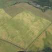
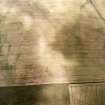
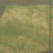
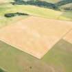
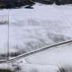
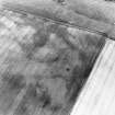
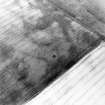
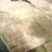
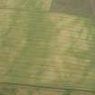
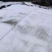
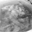
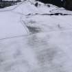
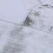
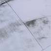
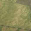
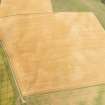
Linear cropmarks, a scatter of pits and what may be a roundhouse have been recorded as cropmarks on oblique aerial photography (RCAHMSAP 1999) lying close to the summit of a small hill about 320m SE of Black Loch. The pits lie among the linear cropmarks, and a circular macular cropmark, measuring about 10m in diameter, may be a roundhouse. A settlement (NT67SE 4) lies immediately to the W and additional linear cropmarks and pits have been recorded to the S (NT67SE 98).
Information from RCAHMS (KMM) 28 January 2005

