
Bairnie Hillock


Barrow (Prehistoric), Cairn (Period Unassigned), Food Vessel
Site Name Bairnie Hillock
Classification Barrow (Prehistoric), Cairn (Period Unassigned), Food Vessel
Alternative Name(s) Hatton Farmhouse
Canmore ID 20288
Site Number NJ91NE 11
NGR NJ 9627 1621
Datum OSGB36 - NGR
Permalink http://canmore.org.uk/site/20288


- Council Aberdeenshire
- Parish Belhelvie
- Former Region Grampian
- Former District Gordon
- Former County Aberdeenshire
NJ91NE 11 9627 1621.
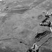
(Location cited as NJ 9628 1622). Bairnie Hillock. This round cairn is situated above Milden Burn on the farm of Hatton. It stands in a prominent position in an area of broom and grass on the edge of an arable field at an altitude of about 26m OD. The ground falls away steeply to the N and the monument looks out to sea. There are large boulders in exposed S edge and possible old land surface in SW corner. The mound is unstable and the farmer's wife reports the tradition of childrens' graves in the mound.
It is clear from the section exposed along a chord of the SW side that the man-made part of the cairn sits on a prominent natural boss of sand which now stands up to 1.5m proud of the present ground surface (on the W side). The make-up of the mound is as follows: turf/sandy soil/large granite boulders/original turf line with charcoal flecking/natural sand boss. It is possible that the boulder layer represents an annular feature around a central space as the boulders are now missing from the sectio exposed on the heavily-eroded SW side. The boulders lie in up to three courses in a layer of 0/86m maximum thickness; they are around 50cm long and 20cm tall. The ?turf line is about 5cm thick and has a possible zone of disturbance immediately below it.
The S edge of the perimeter of the mound was undercut in 1977, the mound was damaged in agricultural operations in September 1979, and suffered erosion from cattle rubbing in 1983.
(GRC/AAS ground photography listed).
NMRS, MS/712/85, visited 19 December 1977 and 20 April 1983..
The small cairn occupying a prominent knoll on the edge of a meltwater channel was excavated owing to its continuing erosion by stock. A two-phase monument was revealed, consisting of a low but substantial circular cairn, c 14m in diameter and 0.8m high, built on a burnt old land surface on which a small quantity of cremated bone and flint flakes had been scattered. This cairn subsequently enlarged by the insertion of a food vessel cremation and the addition of a barrow up to 1.2m high of burnt turf and sandy subsoil.
I A G Shepherd 1984.
This barrow is situated on the edge of an old river terrace 90m N of Hatton farmhouse (NJ91NE 33.00). It was excavated by Shepherd in 1984 and much of the mound that is visible today presumably represents a post-excavation reconstruction. On the date of visit the mound was blanketed with a thick cover of whin bushes and no attempt to measure it was made.
Visited by RCAHMS (JRS, IF), 19 February 1996.

