
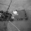
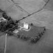
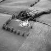
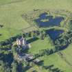
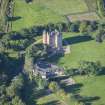
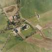
Harthill Castle


Tower House (Medieval)
Site Name Harthill Castle
Classification Tower House (Medieval)
Alternative Name(s) Torries Castle
Canmore ID 18105
Site Number NJ62NE 3
NGR NJ 68659 25175
Datum OSGB36 - NGR
Permalink http://canmore.org.uk/site/18105


First 100 images shown. See the Collections panel (below) for a link to all digital images.
- Council Aberdeenshire
- Parish Oyne
- Former Region Grampian
- Former District Gordon
- Former County Aberdeenshire
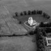
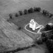
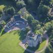
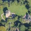
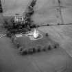
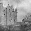
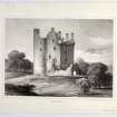
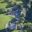
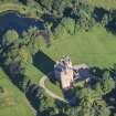
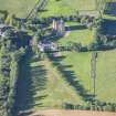
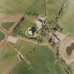
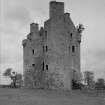
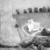
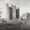
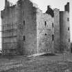
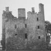
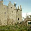
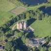
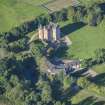
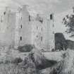
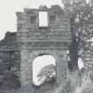
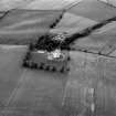
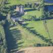
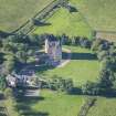
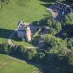
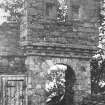
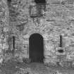
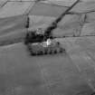
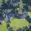
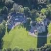
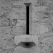
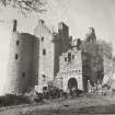
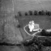
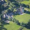
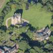
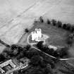
Harthill, c.1600. Chunky Z-plan chateau with small spiky turrets, four storeys containing 19 rooms below a small wallhead walkway, with bedroom stack in round tower, as usual. The original gateway retained in the rebuilt barmkin wall and crisp new garages (1983) in the style of a coachhouse. Internally, cool white and charming; 1975-8, William Cowie.
Taken from "Aberdeenshire: Donside and Strathbogie - An Illustrated Architectural Guide", by Ian Shepherd, 2006. Published by the Rutland Press http://www.rias.org.uk

NJ62NE 3 68659 25175
See also NJ62NE 48.
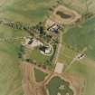
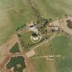
(NJ 6865 2518) Harthill Castle (NR)
OS 6" map, (1959)
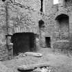
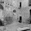
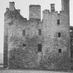
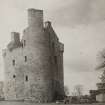
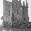
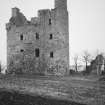
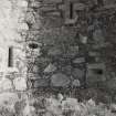
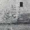
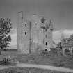
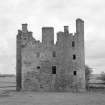
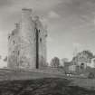
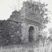
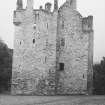
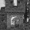
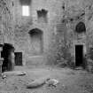
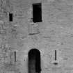
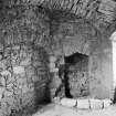
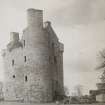
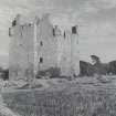
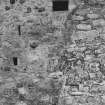
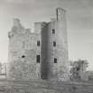
Harthill Castle is the roofless shell of a Z-plan tower-house with the remains of a barmkin wall including the gatehouse. According to MacGibbon and Ross (1915-61) and the SDD it was reputedly built in 1638, but Simpson (1937) and the ONB (1867) give the date as 1601.
D MacGibbon and T Ross 1887-92; SDD 1960-; W D Simpson 1937; Name Book 1867.
Harthill Castle is as described and illustrated by MacGibbon and Ross. The present tenant of Torries recalls seeing a stone dated AD 1601, but this is now lost. Restoration completed 1978.
Information from OS, June 1983.
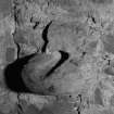
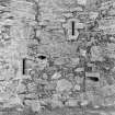
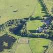
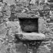
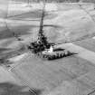
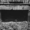
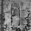
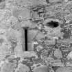
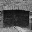
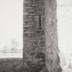
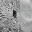
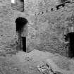
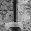
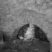
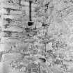
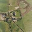
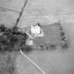
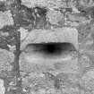
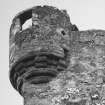
(Classified as Site of Regional Significance; situated on a gentle slope at an altitude of 110m OD). Z-plan tower-house with remains of a barmekin wall, including the gatehouse. Tall main block, four storey and garret in height, with a square tower projecting to the NE and a round tower to the SW; corner turrets at the angles with dressed quoins; well-provided with gunloops. The entrance in the main re-entrant angle has a moulded doorway with deep socket for draw-bar; empty panel space above; basement vaulted; ornate gunloops to guardroom; dome-vaulted cellar in foot of round tower; large arched fireplace in kitchen with its own shot-hole; stone sink and drain. The castle was surrounded by a ditch, of which there is now no trace; it was a ruin but is now fully restored.
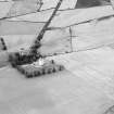
[Air photographic imagery listed].
NMRS, MS/712/35.
Harthill Castle is an inhabited tower-house and was not visited during the course of the Strathdon survey.
Information from RCAHMS (JRS), 17 February 1998.
EXTERNAL REFERENCE:
Plans: Stored in Stafford in 1941 (see architectural catalogue).
Measured and drawn by Peter S Leask 1921-26
Student of Aberdeen School of Architecture
1/2" & F.S. details.
Photographic Survey (June 1962)
Photographic survey of Harthill Castle, Aberdeenshire in 1962 by the Scottish National Buildings Record.

