Kinneddar Archaeological Excavation and Field Evaluation


Date September 1995
Event ID 994911
Category Recording
Type Archaeological Evaluation
Permalink http://canmore.org.uk/event/994911
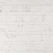
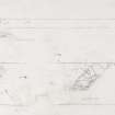
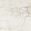
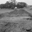
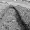
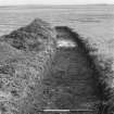
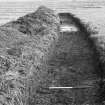
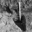
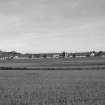
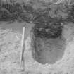
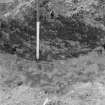
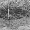
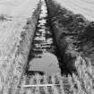
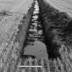
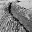
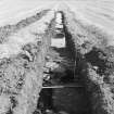
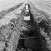
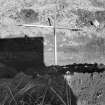
Excavation (location cited as NJ 2243 6969) was carried out by EUCFA in September 1995 to investigate features recorded as cropmarks on (unreferenced) air photographs and as anomalies in geophysical survey (carried out by A Aspinall in 1992); geomorphological coring was also carried out. Twelve trenches were laid out to examine an area of over 900 sq m (mostly to the N of the cemetery) in an attempt to locate Kinneddar Castle, the form of which may be perpetuated by the N and W sides of the field.
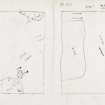
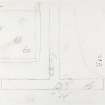
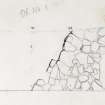
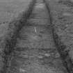
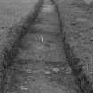
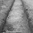
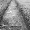
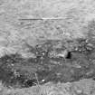
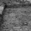
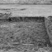
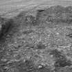
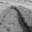
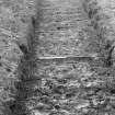
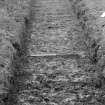
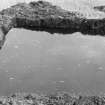
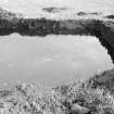
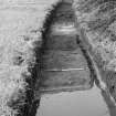
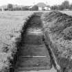
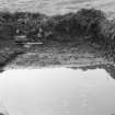
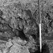
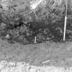
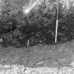
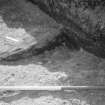
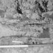
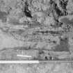
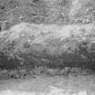
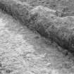
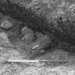
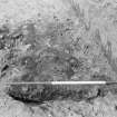
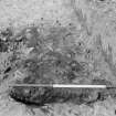
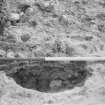
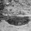
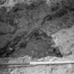
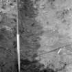
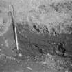
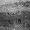
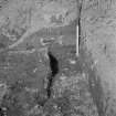
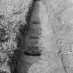
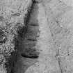
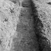
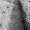
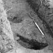
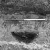
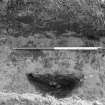
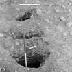
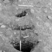
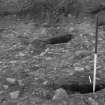
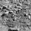
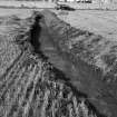
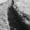
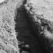
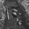
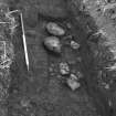
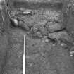
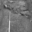
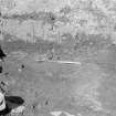
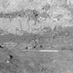
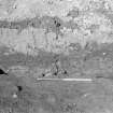
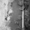
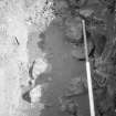
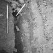
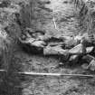
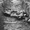
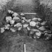
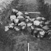
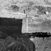
Excavation revealed shallow furrows (aligned E-W) of agricultural origin, pits (of uncertain origin) and natural features. A U-profiled ditch with a silty fill (measuring about 2m wide and 0.5m deep) and the remains of a wall of large angular boulders were identified in trench F, to the N of the cemetery (NJ26NW 2); to the N of the wall there was a dump of silt, clay, charcoal and grit which contained large animal bones, iron fragments and medieval pottery. Trench G (to the N) revealed tumble from a wall to the W of the trench, and trench I (further to the E) revealed a substantial wall, further tumble and a possible U-shaped ditch.
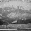
These latter features are interpreted as representing the ploughed-out remains of the hexagonally-shaped structure of the Bishop's Palace.
The excavation archive will be retained by Grampian Regional Council.
Sponsor: Grampian Regional Council.
Information from K Cameron (Edinburgh University Centre for Field Archaeology), October 1995 (NMRS, MS/726/77).
NJ 224 696 An evaluative excavation and geophysical survey were undertaken during September 1995 on the site of Kinneddar Castle (the Bishop's Palace) near Lossiemouth. The prime requirement was to define the extent and limits of features of archaeological interest as an aid to future management stategies for the site.
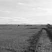
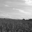
A total of over 900 sq m was excavated in the form of twelve individual trenches. Trenches were positioned primarily around the eastern limits of the known site to the N of the modern cemetery, and on and around the shingle ridge to the S of the cemetery.
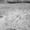
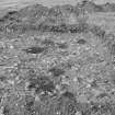
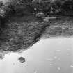
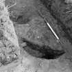
To the S of the cemetery a range of archaeological features were identified. These took the form of pits, dump deposits and cultivation traces.
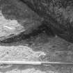
to the N and E of the cemetery trenches revealed traces of a substantial structure. Large walls and ditches were located in three trenches corresponding to documentary and aerial photographic evidence of a concentric hexagonal-shaped structure. A number of animal bones and sherds of medieval pottery were recovered within this feature.
Resistivity surveys conducted after excavation enhanced this picture.
Sponsors: The Moray Society, Moray District Council, Moray, Badenoch and Strathspey Enterprise Company, and Grampian Regional Council.
K Cameron 1995.